MyTopo
Cebollita Peak New Mexico US Topo Map
Couldn't load pickup availability
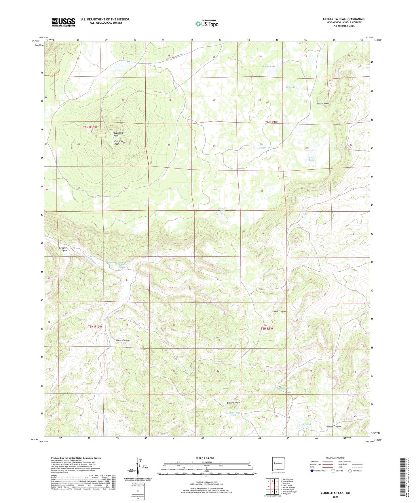
2020 topographic map quadrangle Cebollita Peak in the state of New Mexico. Scale: 1:24000. Based on the newly updated USGS 7.5' US Topo map series, this map is in the following counties: Cibola. The map contains contour data, water features, and other items you are used to seeing on USGS maps, but also has updated roads and other features. This is the next generation of topographic maps. Printed on high-quality waterproof paper with UV fade-resistant inks.
Quads adjacent to this one:
West: Sand Canyon
Northwest: North Pasture
North: Laguna Honda
Northeast: Blue Mesa
East: Mecate Meadow
Southeast: Wiley Mesa
South: Wild Horse Canyon
Southwest: Bonine Canyon
Contains the following named places: Baker Canyon, Cebolla Spring, Cebollita Mesa, Cebollita Peak, Dead Horse Tank, Flag Lake, Gibson Windmill, Gibson WML Water Well, Hughes Pl Water Well, Hughes Place, Jug Tank, Little Cebolla Spring, Major Spring, Middle Lake, Owsley Water Well, Owsley Windmill, Porcupine Lake, Rodeo Lake, Sawmill Tank, Trap Lake, Tub Lakes, Wildcat Windmill, Windmill Number 3, Windmill Number 7