MyTopo
Blue Mesa New Mexico US Topo Map
Couldn't load pickup availability
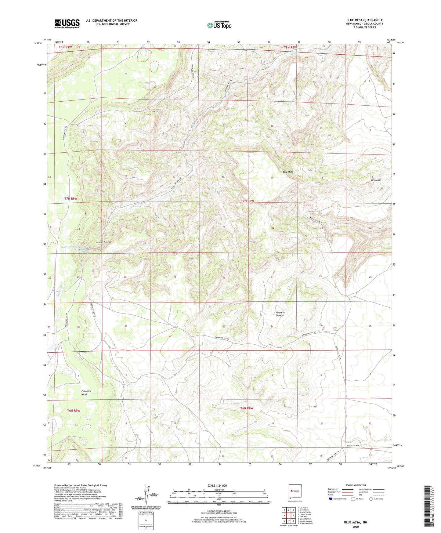
2023 topographic map quadrangle Blue Mesa in the state of New Mexico. Scale: 1:24000. Based on the newly updated USGS 7.5' US Topo map series, this map is in the following counties: Cibola. The map contains contour data, water features, and other items you are used to seeing on USGS maps, but also has updated roads and other features. This is the next generation of topographic maps. Printed on high-quality waterproof paper with UV fade-resistant inks.
Quads adjacent to this one:
West: Laguna Honda
Northwest: Los Pilares
North: Crow Point
Northeast: Acoma Pueblo
East: East Mesa
Southeast: Broom Mountain
South: Mecate Meadow
Southwest: Cebollita Peak
This map covers the same area as the classic USGS quad with code o34107g6.
Contains the following named places: Acoma Number 5 Water Well, Acoma Pueblo, Acoma Purchase, Blue Mesa, Butterfly Spring, Pinon Mountain, Spider Spring, Swamp Spring, Windmill Number 5, Windmill Number 8