MyTopo
Wiley Mesa New Mexico US Topo Map
Couldn't load pickup availability
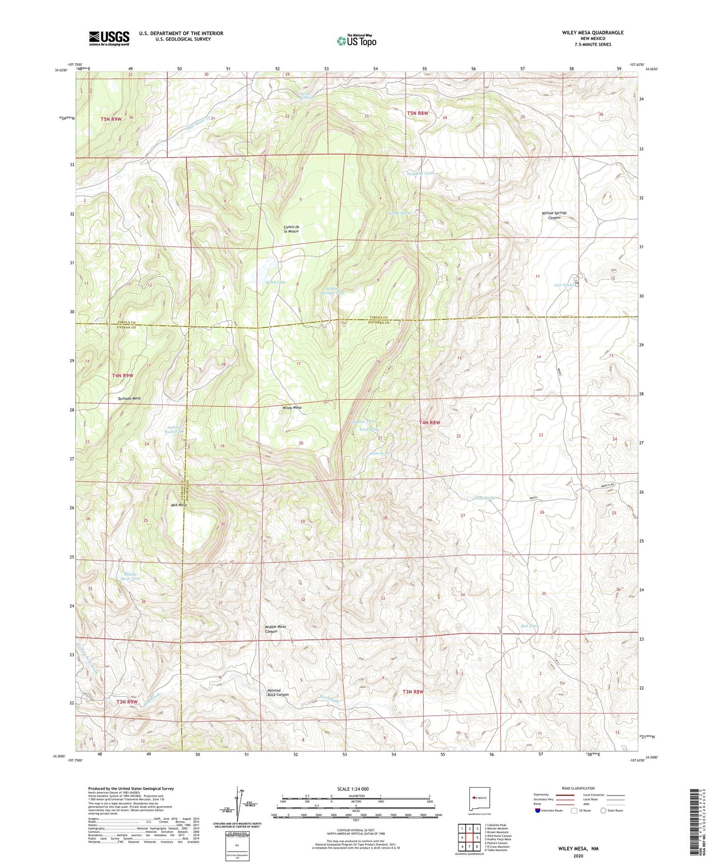
2023 topographic map quadrangle Wiley Mesa in the state of New Mexico. Scale: 1:24000. Based on the newly updated USGS 7.5' US Topo map series, this map is in the following counties: Socorro, Cibola, Catron. The map contains contour data, water features, and other items you are used to seeing on USGS maps, but also has updated roads and other features. This is the next generation of topographic maps. Printed on high-quality waterproof paper with UV fade-resistant inks.
Quads adjacent to this one:
West: Wild Horse Canyon
Northwest: Cebollita Peak
North: Mecate Meadow
Northeast: Broom Mountain
East: Pueblo Viejo Mesa
Southeast: Table Mountain
South: D Cross Mountain
Southwest: Pasture Canyon
This map covers the same area as the classic USGS quad with code o34107e6.
Contains the following named places: Barela Water Well, Barela Well, Carr Windmill, Gist Tanks, Karr Windmill Water Well, Kicking Bear Wash, La Mosca Water Well, Latta Tanks, Manning Cabin, Middle Mesa, Middle Mesa Canyon, Middle Mesa Tank, Ojo de la Mosca, Painted Rock Canyon, Painted Rock Tank, Red Lake, Rincon Water Well, Rincon Windmill, S O B Water Well, Saddle Windmill, Saddle WM Water Well, Tadpole Tank, Watson Windmill, Watson Windmill Water Well, Wedding Tank, Wiley Lake, Wiley Mesa, Wiley Spring, Willow Spring, Willow Springs Canyon, Willow Springs Tank, Wylie Spring