MyTopo
Chimney Rock New Mexico US Topo Map
Couldn't load pickup availability
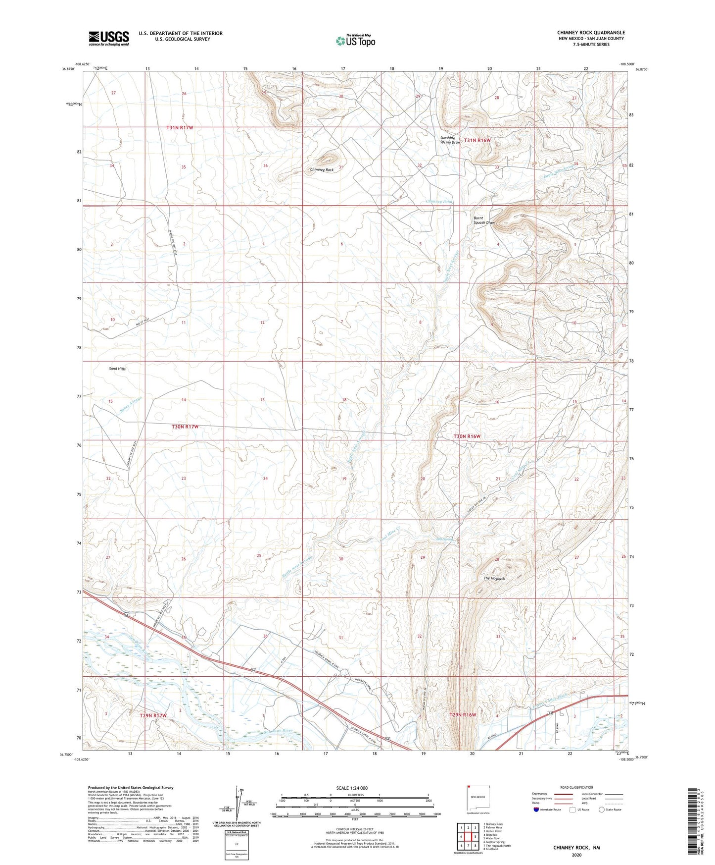
2023 topographic map quadrangle Chimney Rock in the state of New Mexico. Scale: 1:24000. Based on the newly updated USGS 7.5' US Topo map series, this map is in the following counties: San Juan. The map contains contour data, water features, and other items you are used to seeing on USGS maps, but also has updated roads and other features. This is the next generation of topographic maps. Printed on high-quality waterproof paper with UV fade-resistant inks.
Quads adjacent to this one:
West: Shiprock
Northwest: Skinney Rock
North: Palmer Mesa
Northeast: Heifer Point
East: Waterflow
Southeast: Fruitland
South: The Hogback North
Southwest: Sulphur Spring
This map covers the same area as the classic USGS quad with code o36108g5.
Contains the following named places: Agency Coal Mine, Burnt Squash Draw, Chimney Pond, Chimney Rock, Coal Mine Creek, Eagle Nest Arroyo, Hogback Chapter, Hogback Trading Post, Jewett Valley, OT-1 Water Well, Salt Spring, Sand Hills, Sunshine Spring Draw, WS-2 Water Well, WS-3 Water Well, WS-4 Water Well, WS-5 Water Well, ZIP Code: 87421