MyTopo
Shiprock New Mexico US Topo Map
Couldn't load pickup availability
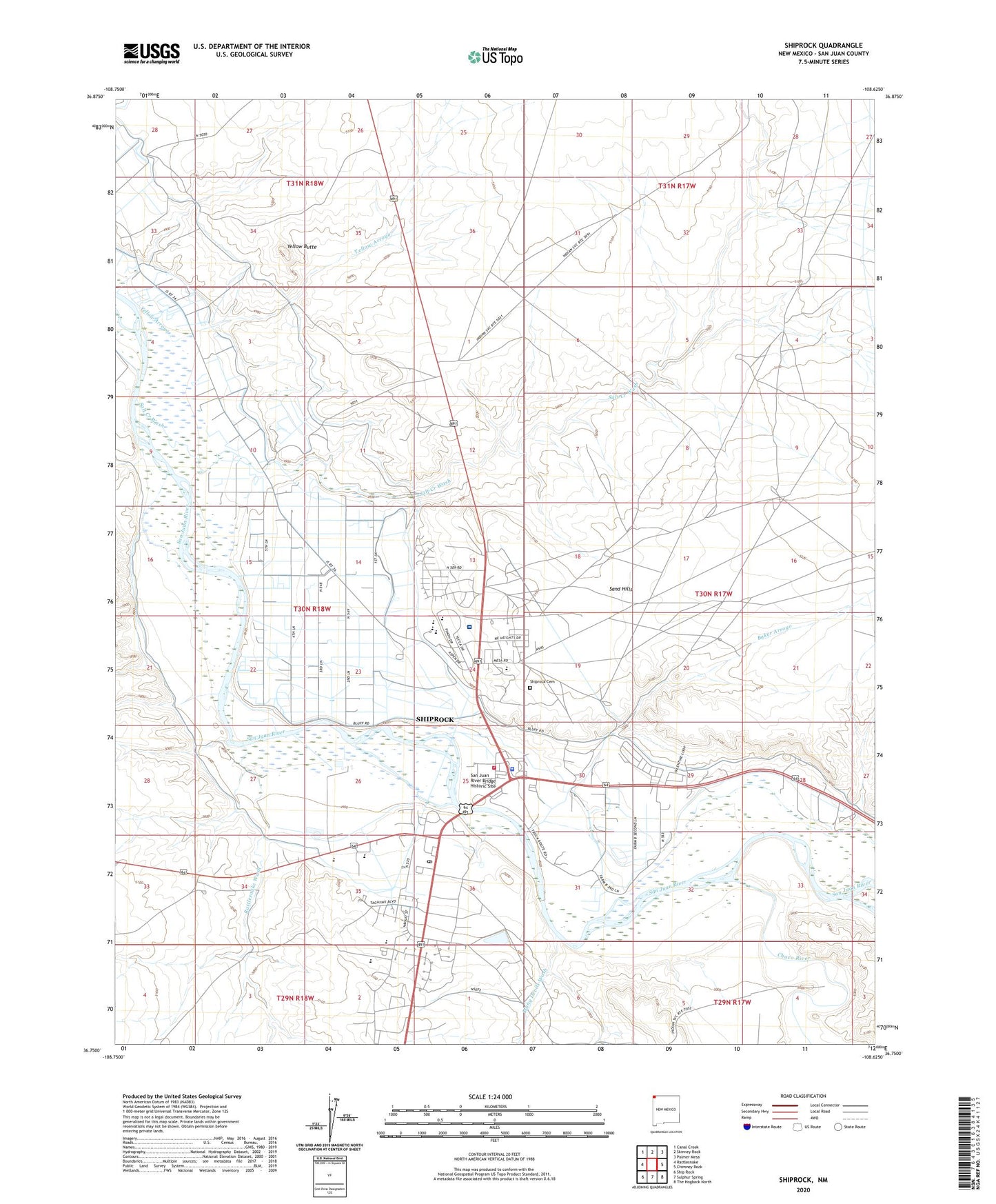
2023 topographic map quadrangle Shiprock in the state of New Mexico. Scale: 1:24000. Based on the newly updated USGS 7.5' US Topo map series, this map is in the following counties: San Juan. The map contains contour data, water features, and other items you are used to seeing on USGS maps, but also has updated roads and other features. This is the next generation of topographic maps. Printed on high-quality waterproof paper with UV fade-resistant inks.
Quads adjacent to this one:
West: Rattlesnake
Northwest: Canal Creek
North: Skinney Rock
Northeast: Palmer Mesa
East: Chimney Rock
Southeast: The Hogback North
South: Sulphur Spring
Southwest: Ship Rock
This map covers the same area as the classic USGS quad with code o36108g6.
Contains the following named places: 12K-300A Water Well, 12T-520 Water Well, Baker Arroyo, Beclabito Chapel, Blanchard Mine, Blue Gap/Four Corners United Methodist Church, Chaco River, Ditch Number Eight, Ditch Number Nine, Enos Johnson Mine, First Baptist Church, Many Devils Wash, Mesa Elementary School, Mesa View Assembly Church, Natanni Nez Elementary School, Navajo Community College, Navajo Community College Library, Navajo Nation Fire and Rescue Services - Station 20 Shiprock, Navajo Nation Police Station, Nelson Pit and Shady Side, Nizhoni Elementary School, Northern Navajo Medical Center, Pictured Cliffs Historic Site, Rattlesnake Wash, Salt Creek Wash, San Juan River Bridge Historic Site, Shiprock, Shiprock Alternative Kindergarten School, Shiprock Alternative School, Shiprock Cemetery, Shiprock Census Designated Place, Shiprock Community Health Center, Shiprock Community Health Center Library, Shiprock Northwest High School, Shiprock Pit, Shiprock Post Office, Shiprock United Methodist Church, Shiprock Weather Station, Tse' Bit' ai Mid School, USIS Water Well, Yellow Arroyo, Yellow Butte