MyTopo
Miami NE New Mexico US Topo Map
Couldn't load pickup availability
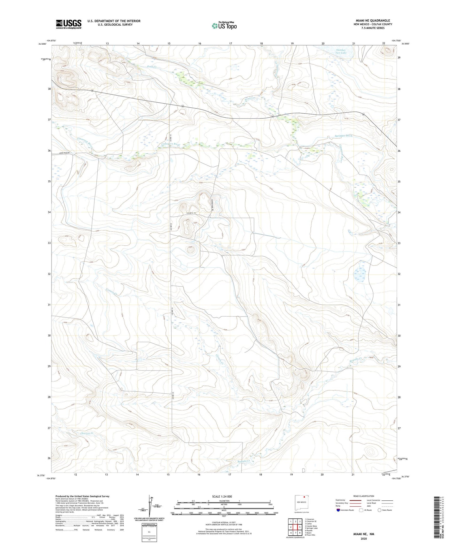
2023 topographic map quadrangle Miami NE in the state of New Mexico. Scale: 1:24000. Based on the newly updated USGS 7.5' US Topo map series, this map is in the following counties: Colfax. The map contains contour data, water features, and other items you are used to seeing on USGS maps, but also has updated roads and other features. This is the next generation of topographic maps. Printed on high-quality waterproof paper with UV fade-resistant inks.
Quads adjacent to this one:
West: Coyote Mesa
Northwest: Cimarron
North: Cimarron SE
Northeast: Colfax
East: Springer Lake
Southeast: Pinon Hills
South: Miami
Southwest: Rayado
This map covers the same area as the classic USGS quad with code o36104d7.
Contains the following named places: C S Ranch, C S Ranch Airport, Cerrososo Creek, Cimarroncito Creek, Crawford, Encinosa Creek, Hanson Farm, Hayward Farm, McDaniel, McDaniel Cimarron Place, Ponil Creek, Urraca Creek, Urraca Place