MyTopo
Clayton New Mexico US Topo Map
Couldn't load pickup availability
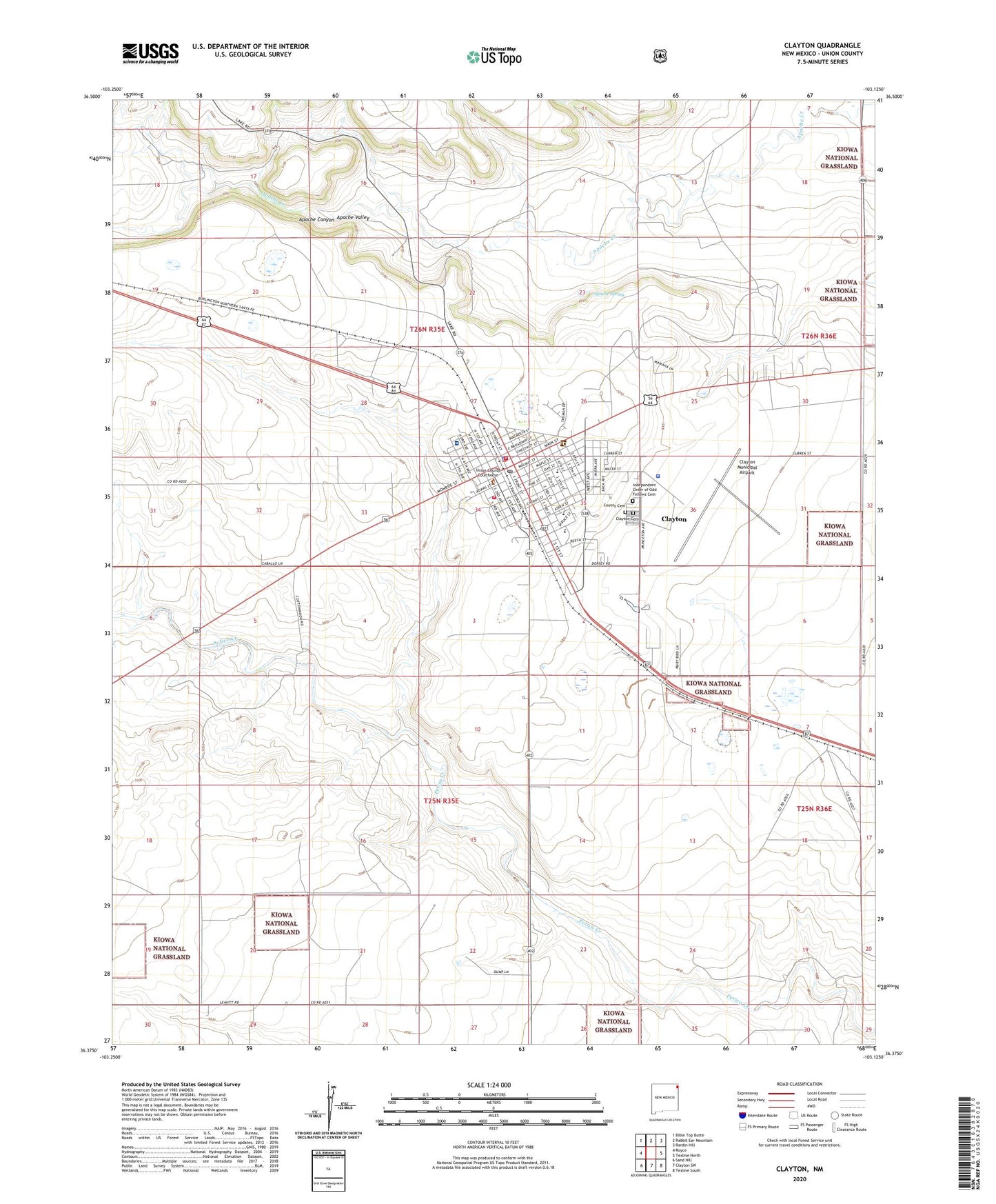
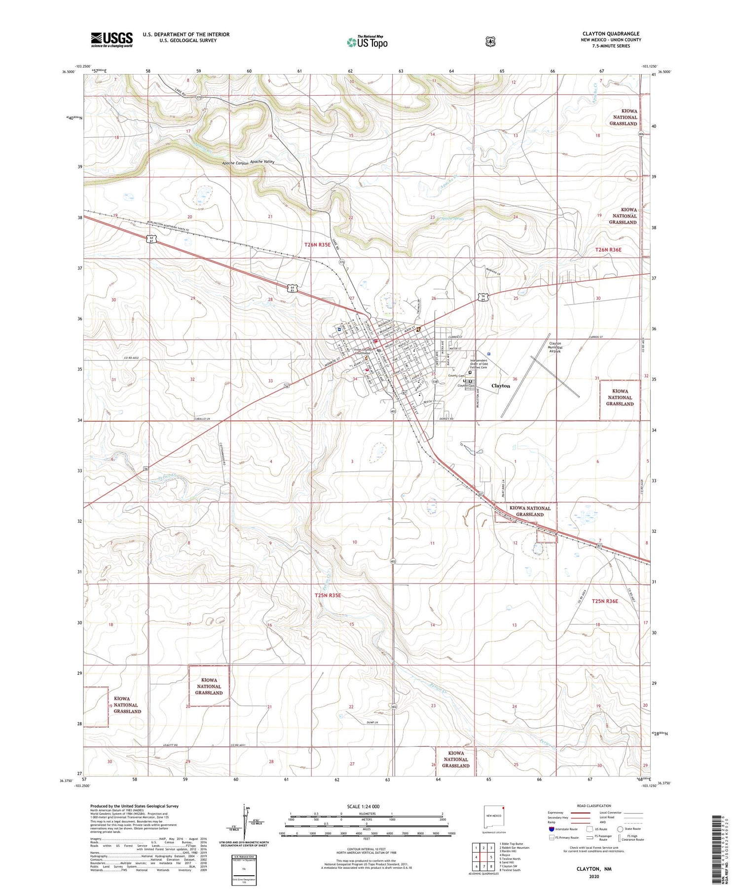
2020 topographic map quadrangle Clayton in the state of New Mexico. Scale: 1:24000. Based on the newly updated USGS 7.5' US Topo map series, this map is in the following counties: Union. The map contains contour data, water features, and other items you are used to seeing on USGS maps, but also has updated roads and other features. This is the next generation of topographic maps. Printed on high-quality waterproof paper with UV fade-resistant inks.
Quads adjacent to this one:
West: Royce
Northwest: Bible Top Butte
North: Rabbit Ear Mountain
Northeast: Rardin Hill
South: Clayton SW
Southwest: Sand Hill
Contains the following named places: Albert W Thompson Memorial Library, Alvis School, Amistad Elementary School, Apache Canyon, Apache Spring, Assembly of God Church, Church of Christ, Church of God, Clayton, Clayton Cemetery, Clayton Fire Rescue Station 1, Clayton Fire Rescue Station 2, Clayton High School, Clayton Historical Marker, Clayton Junior High School, Clayton Municipal Airpark, Clayton Police Department, Clayton Post Office, County Cemetery, Double A Feeders, Eklund Hotel Historic Site, Eklund Storage Works Dam, First Baptist Church, First United Methodist Church, Gospel Center, Herzstein Memorial Museum Historic Site, Independent Order of Odd Fellows Cemetery, Jehovahs Witnesses Church, Kiowa and Rita Blanca Ranger District Office, Kiser School, KLMX-AM (Clayton), KOA Campground, Leighton Grove, NASA Wind Charger, Rabbit Ear Fire Department Main Station, Saint Francis Xavier Catholic Church, Santa Fe Trail Rest Area, Seventh Day Adventist Church, Town of Clayton, Union County Courthouse Historic Site, Union County General Hospital, Union County General Hospital Medical Library, Union County Sheriff's Office