MyTopo
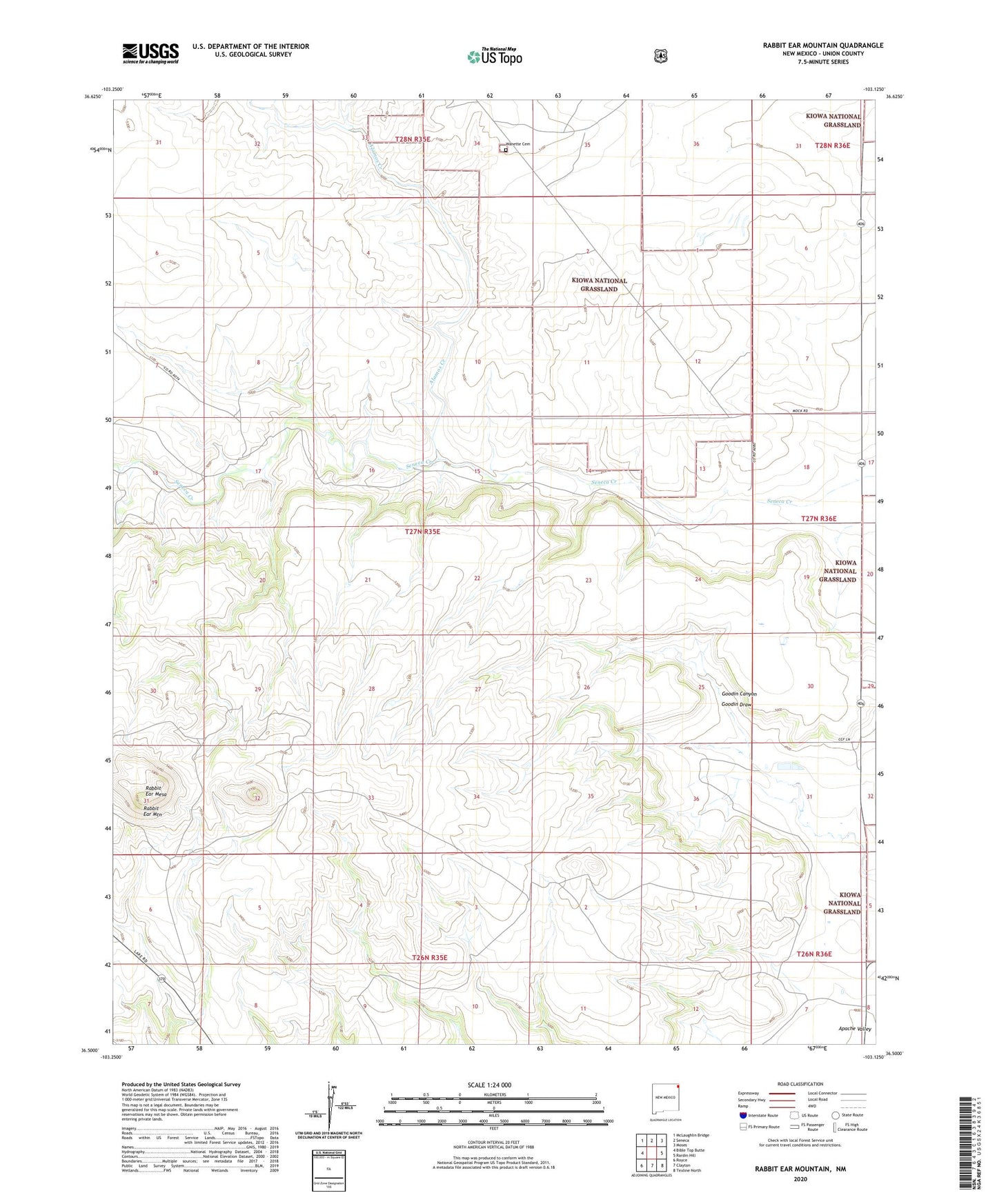
Rabbit Ear Mountain New Mexico US Topo Map
Couldn't load pickup availability
Also explore the Rabbit Ear Mountain Forest Service Topo of this same quad for updated USFS data
2023 topographic map quadrangle Rabbit Ear Mountain in the state of New Mexico. Scale: 1:24000. Based on the newly updated USGS 7.5' US Topo map series, this map is in the following counties: Union. The map contains contour data, water features, and other items you are used to seeing on USGS maps, but also has updated roads and other features. This is the next generation of topographic maps. Printed on high-quality waterproof paper with UV fade-resistant inks.
Quads adjacent to this one:
West: Bible Top Butte
Northwest: McLaughlin Bridge
North: Seneca
Northeast: Moses
East: Rardin Hill
South: Clayton
Southwest: Royce
This map covers the same area as the classic USGS quad with code o36103e2.
Contains the following named places: Alamos Creek, Black Jack Ketchum Historical Marker, Clayton Cattle Feeders Incorporated Feed Lot, Forty Acre Well, Goodin Canyon, Rabbit Ear Mesa, Rabbit Ear Mountain, Rabbit Ear Mountains Historical Marker, Reeves Cemetery, Wanette, Wanette Cemetery, Wanette Post Office