MyTopo
Cooper-Good Ranch New Mexico US Topo Map
Couldn't load pickup availability
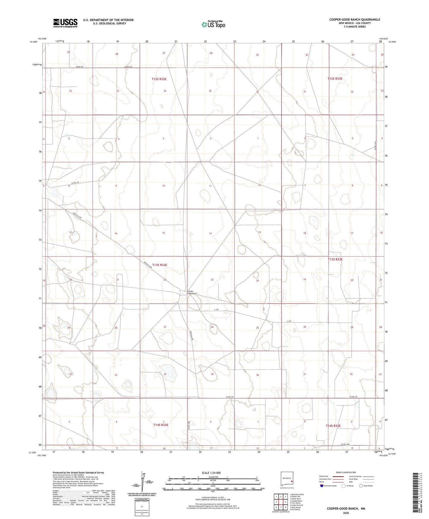
2023 topographic map quadrangle Cooper-Good Ranch in the state of New Mexico. Scale: 1:24000. Based on the newly updated USGS 7.5' US Topo map series, this map is in the following counties: Lea. The map contains contour data, water features, and other items you are used to seeing on USGS maps, but also has updated roads and other features. This is the next generation of topographic maps. Printed on high-quality waterproof paper with UV fade-resistant inks.
Quads adjacent to this one:
West: Caudill Ranch
Northwest: Mescalero Point
North: Soldier Hill
Northeast: Dallas Store
East: Frier Ranch
Southeast: Fort Ranch
South: Dean Ranch
Southwest: Cedar Point SE
This map covers the same area as the classic USGS quad with code o33103b6.
Contains the following named places: 10024 Water Well, 10025 Water Well, 10749 Water Well, 10750 Water Well, 10929 Water Well, 10930 Water Well, 10934 Water Well, 10935 Water Well, 10936 Water Well, 10937 Water Well, 10938 Water Well, 10939 WAter Well, 10940 Water Well, 10942 Water Well, 10943 Water Well, 10946 Water Well, 10947 Water Well, 10950 Water Well, 10955 Water Well, 10956 Water Well, Baum North Oil Field, Baum Oil Field, Cooper-Good Ranch, Price Ranch