MyTopo
Cooper Ranch New Mexico US Topo Map
Couldn't load pickup availability
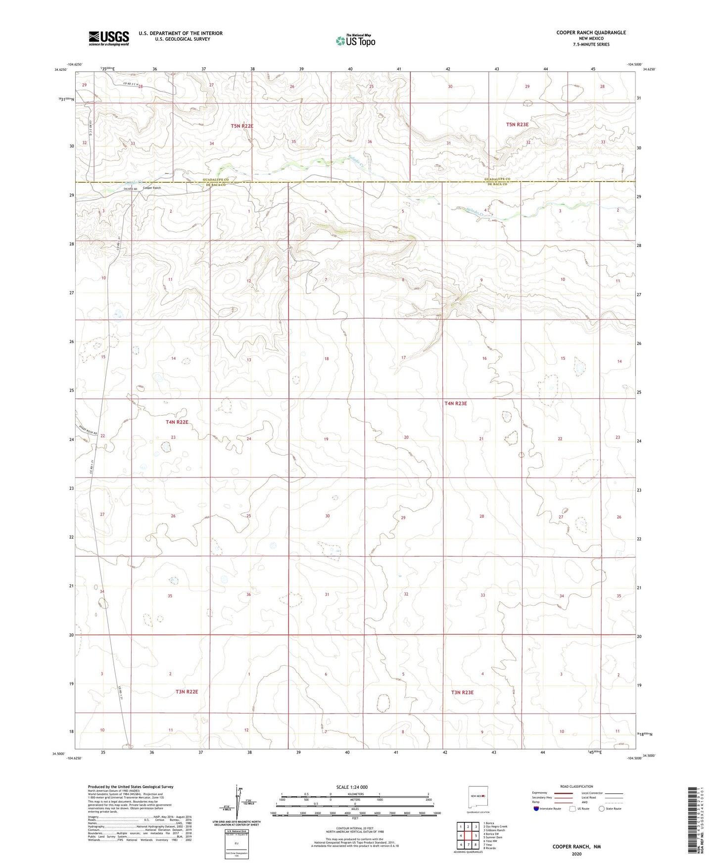
2023 topographic map quadrangle Cooper Ranch in the state of New Mexico. Scale: 1:24000. Based on the newly updated USGS 7.5' US Topo map series, this map is in the following counties: De Baca, Guadalupe. The map contains contour data, water features, and other items you are used to seeing on USGS maps, but also has updated roads and other features. This is the next generation of topographic maps. Printed on high-quality waterproof paper with UV fade-resistant inks.
Quads adjacent to this one:
West: Borica SW
Northwest: Borica
North: Ojo Negro Creek
Northeast: Gibbons Ranch
East: Sumner Dam
Southeast: Ricardo
South: Yeso
Southwest: Yeso NW
This map covers the same area as the classic USGS quad with code o34104e5.
Contains the following named places: 10270 Water Well, 10271 Water Well, 10462 Water Well, 10463 Water Well, 10464 Water Well, 10465 Water Well, 10466 Water Well, 10467 Water Well, 10471 Water Well, 10472 Water Well, 10898 Water Well, 10899 Water Well, 10902 Water Well, 10903 Water Well, 10905 Water Well, Cooper, Cooper Ranch, Upper Wagon Windmill