MyTopo
Cottonwood Springs New Mexico US Topo Map
Couldn't load pickup availability
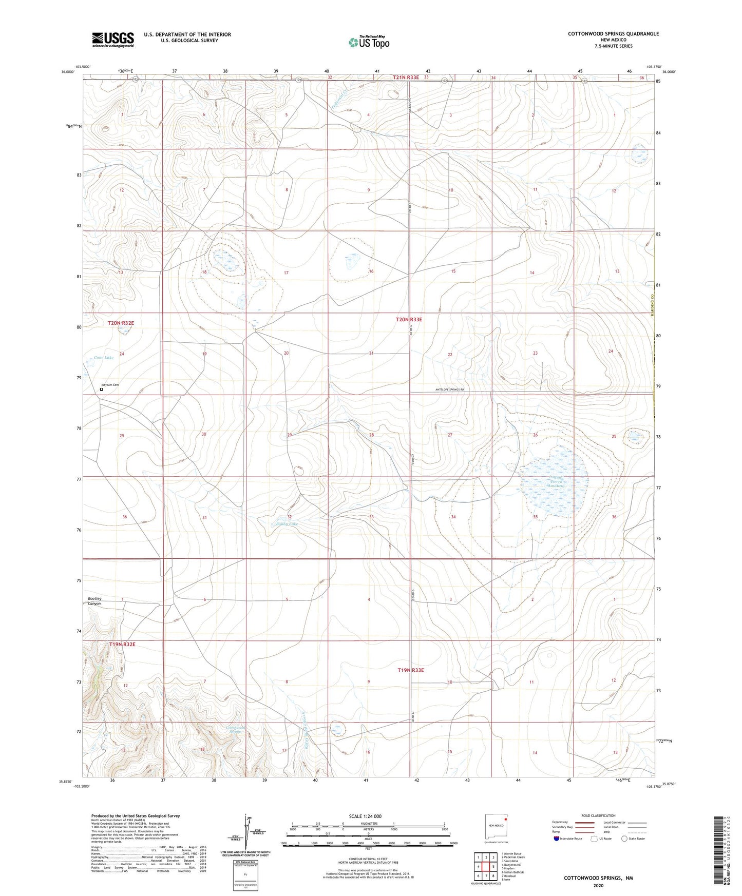
2020 topographic map quadrangle Cottonwood Springs in the state of New Mexico. Scale: 1:24000. Based on the newly updated USGS 7.5' US Topo map series, this map is in the following counties: Harding, Union. The map contains contour data, water features, and other items you are used to seeing on USGS maps, but also has updated roads and other features. This is the next generation of topographic maps. Printed on high-quality waterproof paper with UV fade-resistant inks.
Quads adjacent to this one:
West: Bueyeros NE
Northwest: Minnie Butte
North: Pedernal Creek
Northeast: Skull Mesa
East: Hayden
Southeast: Ione
South: Rosebud
Southwest: Indian Bathtub
Contains the following named places: Adee, Amoco Number One State E N, Big West Central Well, Bobby Lake, Chaffee Well, Cone, Cone Lake, Cottonwood Springs, Crane Well, East Well, East West Central Well, Ells Well, Grover Well, Hemphill Well, Laguna Tierra Amatosa, Maytum Cemetery, Mosier Well, North Jackard Well, North School Section Well, Northwest Holbert Well, Northwest Well, Old Swoyer Well, Red Well, Scales Well, School Section Well, Sidenor Well, South Scales Well, South School Section Well, Tompkins, Vaughtrin Well, Whiteside Ranch, Zahn Well