MyTopo
Indian Bathtub New Mexico US Topo Map
Couldn't load pickup availability
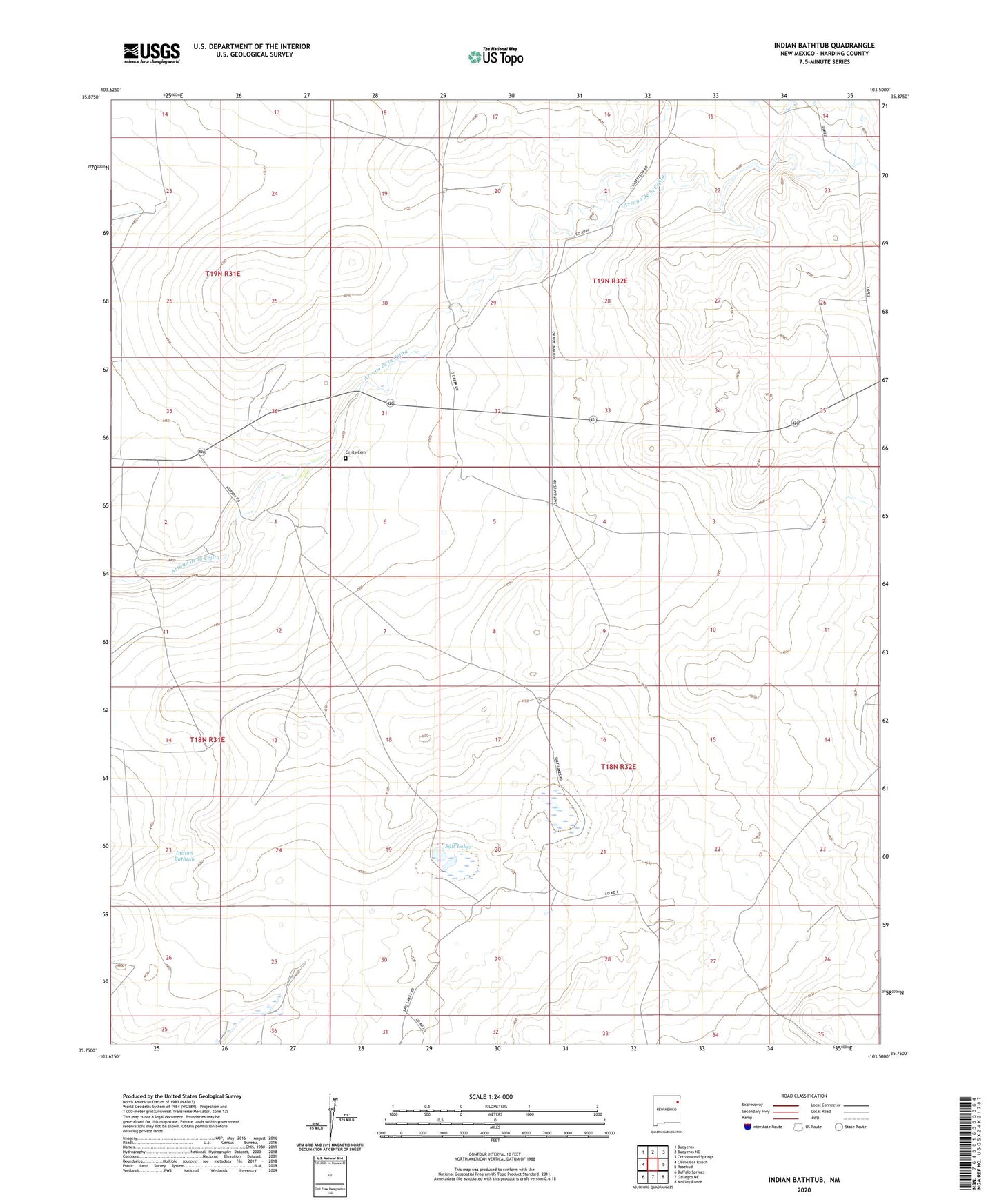
2023 topographic map quadrangle Indian Bathtub in the state of New Mexico. Scale: 1:24000. Based on the newly updated USGS 7.5' US Topo map series, this map is in the following counties: Harding. The map contains contour data, water features, and other items you are used to seeing on USGS maps, but also has updated roads and other features. This is the next generation of topographic maps. Printed on high-quality waterproof paper with UV fade-resistant inks.
Quads adjacent to this one:
West: Circle Bar Ranch
Northwest: Bueyeros
North: Bueyeros NE
Northeast: Cottonwood Springs
East: Rosebud
Southeast: McCloy Ranch
South: Gallegos NE
Southwest: Buffalo Springs
This map covers the same area as the classic USGS quad with code o35103g5.
Contains the following named places: Cejita Cemetery, East Graveyard Windmill, East Twin Windmill, Garden Windmill, Harris Windmills, Indian Bathtub, Lambert, Largo Windmill, Little Johnny Windmill, Lonez Well Number 1, Lopez Well Number 2, Louis Windmills, Medano Windmill, New Pasture Windmill, North Creek Windmill, Poso Windmill, Rosebud Windmill, Salada Windmill, Salt Lakes, Sheep Fence Windmill, Twin Windmills, West Graveyard Windmill