MyTopo
Rosebud New Mexico US Topo Map
Couldn't load pickup availability
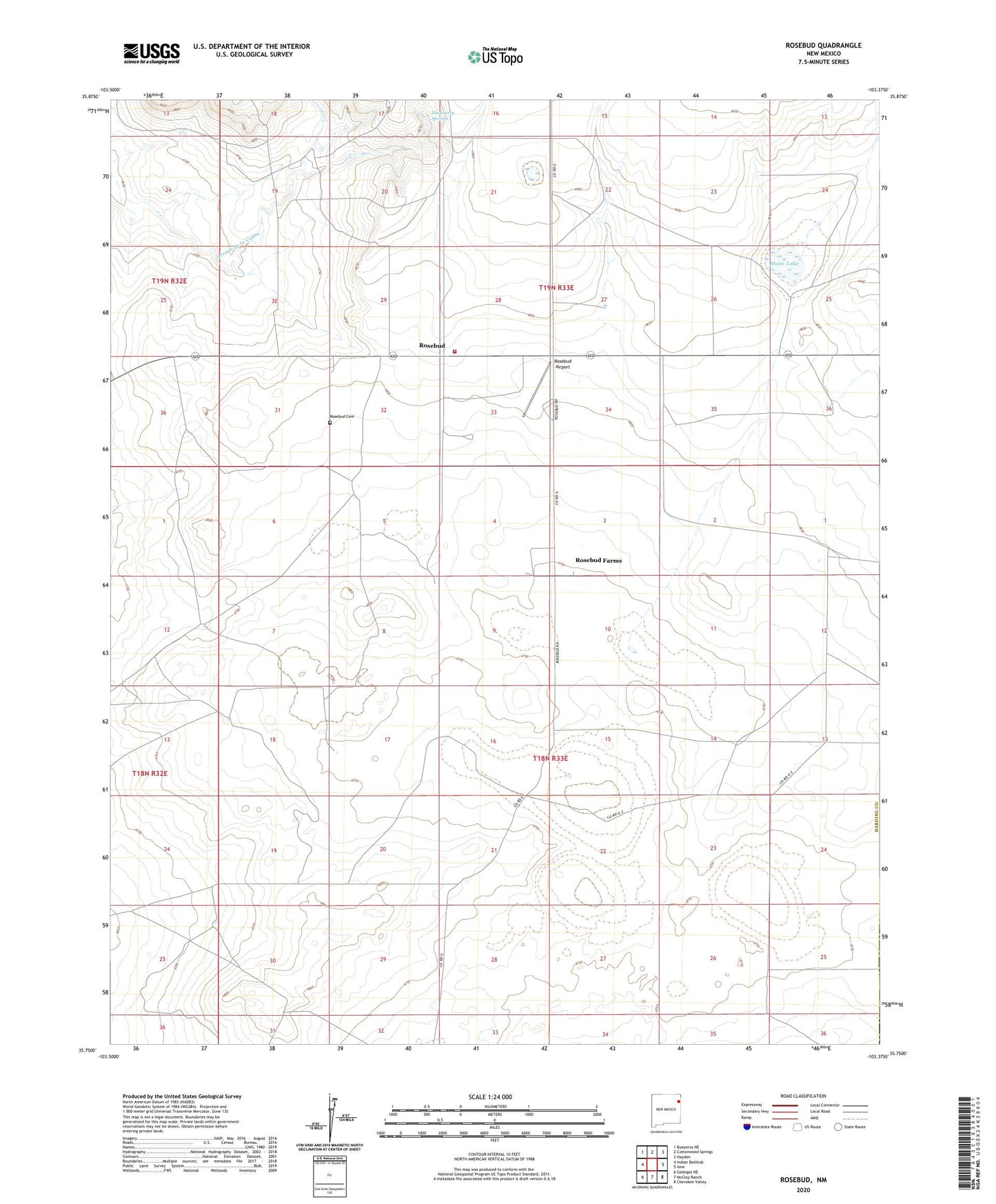
2023 topographic map quadrangle Rosebud in the state of New Mexico. Scale: 1:24000. Based on the newly updated USGS 7.5' US Topo map series, this map is in the following counties: Harding, Union. The map contains contour data, water features, and other items you are used to seeing on USGS maps, but also has updated roads and other features. This is the next generation of topographic maps. Printed on high-quality waterproof paper with UV fade-resistant inks.
Quads adjacent to this one:
West: Indian Bathtub
Northwest: Bueyeros NE
North: Cottonwood Springs
Northeast: Hayden
East: Ione
Southeast: Cherokee Valley
South: McCloy Ranch
Southwest: Gallegos NE
This map covers the same area as the classic USGS quad with code o35103g4.
Contains the following named places: Brune, Brune School Section Well, Brune Well, Freed Pen Well, Hackberry Springs, Matis Lake, Matis Well, Miner Well, North Middle Well, Rosebud, Rosebud Airport, Rosebud Cemetery, Rosebud Farms, Rosebud Fire and Rescue Station 1 Main Station, Rosebud Post Office, Shipping Pen Well