MyTopo
Hayden New Mexico US Topo Map
Couldn't load pickup availability
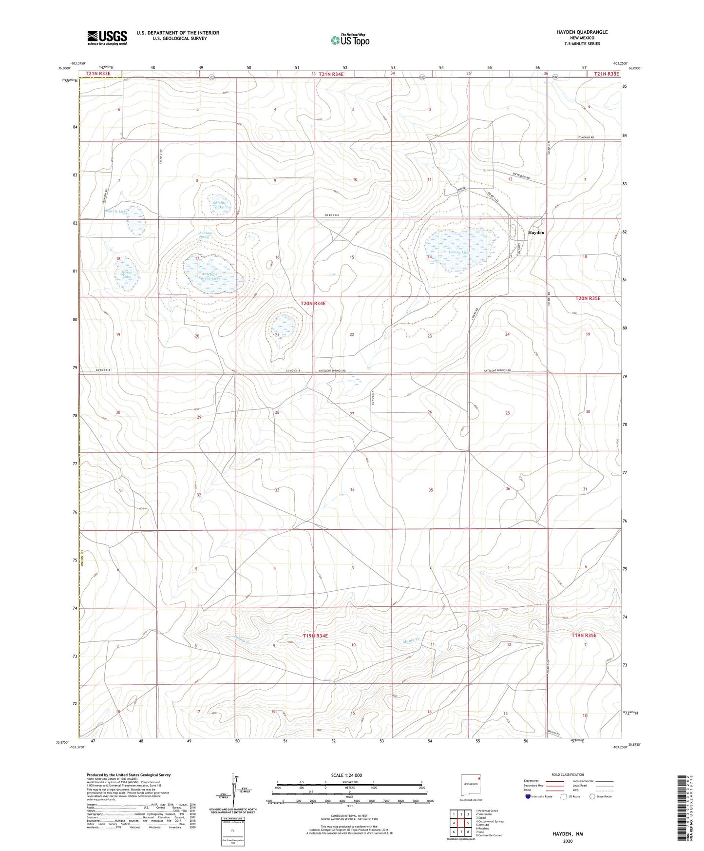
2023 topographic map quadrangle Hayden in the state of New Mexico. Scale: 1:24000. Based on the newly updated USGS 7.5' US Topo map series, this map is in the following counties: Union, Harding. The map contains contour data, water features, and other items you are used to seeing on USGS maps, but also has updated roads and other features. This is the next generation of topographic maps. Printed on high-quality waterproof paper with UV fade-resistant inks.
Quads adjacent to this one:
West: Cottonwood Springs
Northwest: Pedernal Creek
North: Skull Mesa
Northeast: Stead
East: Amistad
Southeast: Centerville Corner
South: Ione
Southwest: Rosebud
This map covers the same area as the classic USGS quad with code o35103h3.
Contains the following named places: Antelope Spring, Antelope Spring Lake, Bates Well, Bell Well, Brown Well, Claude Hutcherson Number 1 Dam, Claude Hutcherson Number 1 Reservoir, Claude Hutcherson Number 2 Dam, Claude Hutcherson Number 3 Dam, Claude Hutcherson Number 4 Dam, Claude Hutcherson Number 5 Dam, Claude Hutcherson Number 5 Reservoir, Claude Hutcherson Number Four Reservoir, Claude Hutcherson Number Three Reservoir, Claude Hutcherson Number Two Reservoir, Cushman Well, Dickson Well, Draw Well, Dubois Well, East Bates Well, East Garden Well, Garden Well, Golf Well, Haltaman Well, Hayden, Hayden Cemetery, Hayden Post Office, Hayden Weather Station, Heimann Ranch, Holy Trinity Catholic Cemetery, Horse Lake, Hutcherson Ranch, Jacobs Ranch, Jake Well, Jueschke Well, Lowry Lake, Morris Lake, Morris Well, Northwest Hobart Well, Parmer Well, Patman Well, Reed Well, School Section Well, Shields Lake, South Morris Well, Spring Well, Thompson Well, ZIP Code: 88410