MyTopo
Coyote Mesa New Mexico US Topo Map
Couldn't load pickup availability
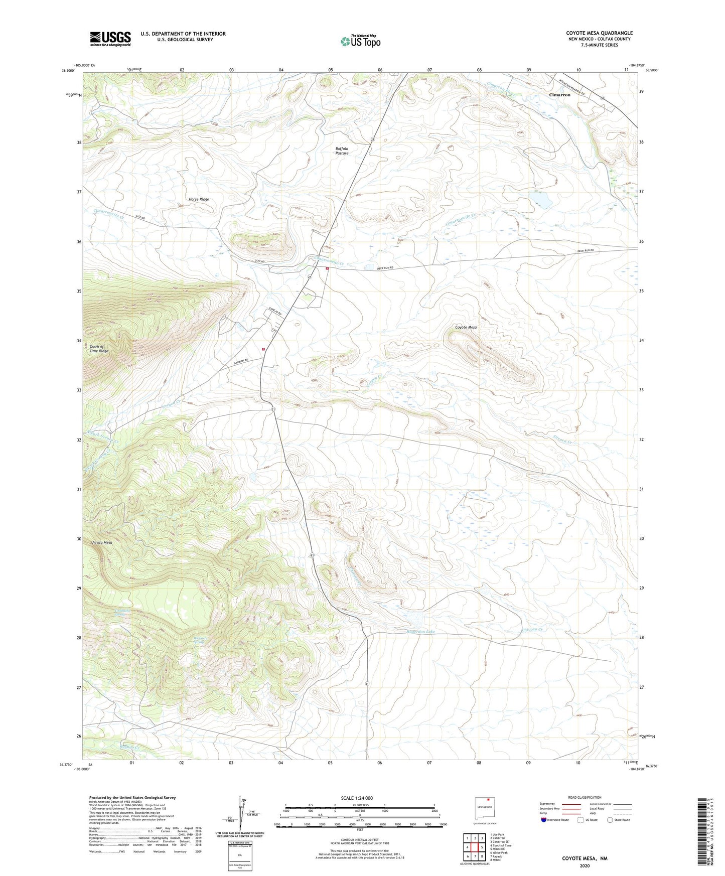
2020 topographic map quadrangle Coyote Mesa in the state of New Mexico. Scale: 1:24000. Based on the newly updated USGS 7.5' US Topo map series, this map is in the following counties: Colfax. The map contains contour data, water features, and other items you are used to seeing on USGS maps, but also has updated roads and other features. This is the next generation of topographic maps. Printed on high-quality waterproof paper with UV fade-resistant inks.
Quads adjacent to this one:
West: Tooth of Time
Northwest: Ute Park
North: Cimarron
Northeast: Cimarron SE
East: Miami NE
Southeast: Miami
South: Rayado
Southwest: White Peak
Contains the following named places: Backache Spring, Badger Camp, Buffalo Pasture, Colfax County Fire Department District 1 Philmont, Colfax Fire Department District 1 Philmont Substation, Coyote Mesa, Dry Lake Dam, Hagadorn Reservoir Number 5 Dam, Hagerdon Lake, Horse Ridge, Lewis Lake, Lewis Reservoir Dam, North Fork Urraca Creek, Philmont Museum, Philmont Scout Ranch Headquarters, Rocky Mountain Scout Camp, South Fork Urraca Creek, Tooth of Time Ridge, Tooth Ridge Camp, Toothache Spring, Toothache Spring Camp, Urraca Camp, Urraca Mesa, Zastro Camp, ZIP Code: 87714