MyTopo
Crow Mesa West New Mexico US Topo Map
Couldn't load pickup availability
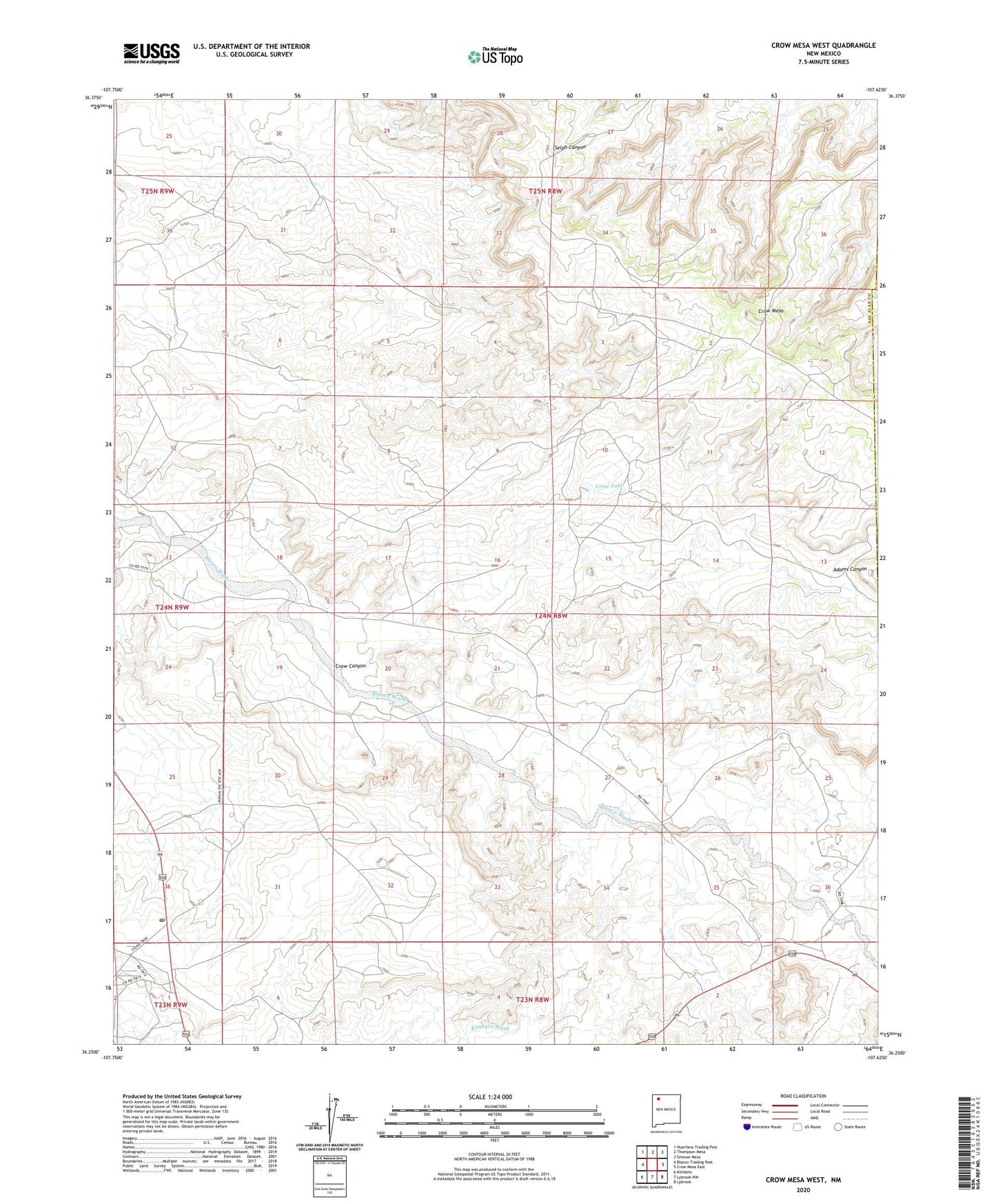
2023 topographic map quadrangle Crow Mesa West in the state of New Mexico. Scale: 1:24000. Based on the newly updated USGS 7.5' US Topo map series, this map is in the following counties: San Juan, Rio Arriba. The map contains contour data, water features, and other items you are used to seeing on USGS maps, but also has updated roads and other features. This is the next generation of topographic maps. Printed on high-quality waterproof paper with UV fade-resistant inks.
Quads adjacent to this one:
West: Blanco Trading Post
Northwest: Huerfano Trading Post
North: Thompson Mesa
Northeast: Smouse Mesa
East: Crow Mesa East
Southeast: Lybrook
South: Lybrook NW
Southwest: Kimbeto
This map covers the same area as the classic USGS quad with code o36107c6.
Contains the following named places: 1 English Water Well, 19T-342 Water Well, 19T-349 Water Well, 19T-510 Water Well, Adams Canyon, Bible Baptist Shepherd, Cricket Dam, Crow Canyon, Crow Lake, Crow Mesa, LaCopita Dam, Nageezi, Nageezi Dam, Nageezi Post Office, Romulo Martinez Trading Post Historic Site