
MyTopo
Cuervo New Mexico US Topo Map
Couldn't load pickup availability
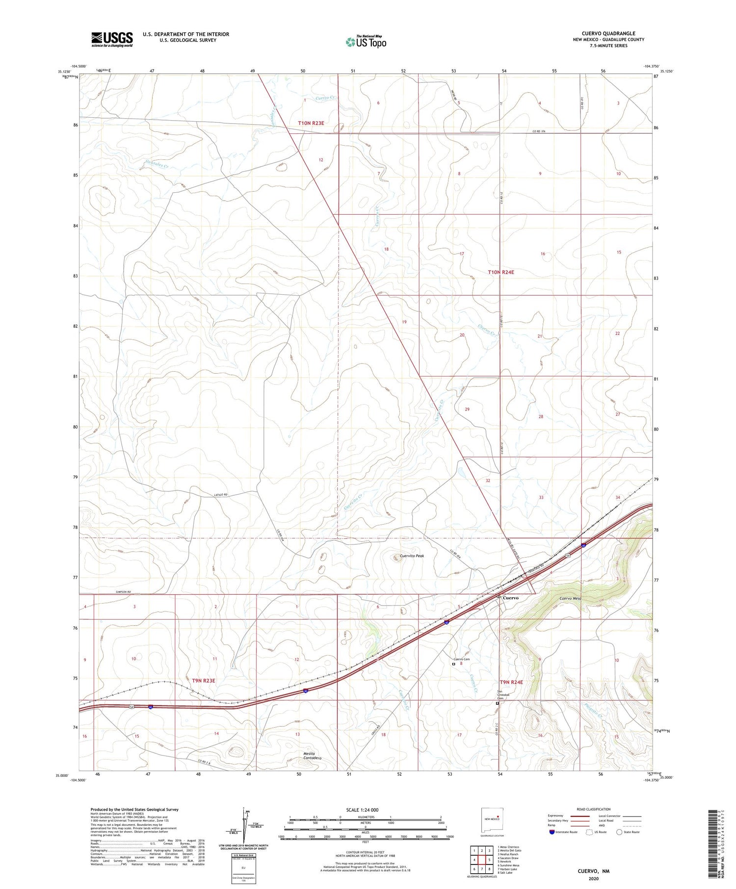
2020 topographic map quadrangle Cuervo in the state of New Mexico. Scale: 1:24000. Based on the newly updated USGS 7.5' US Topo map series, this map is in the following counties: Guadalupe. The map contains contour data, water features, and other items you are used to seeing on USGS maps, but also has updated roads and other features. This is the next generation of topographic maps. Printed on high-quality waterproof paper with UV fade-resistant inks.
Quads adjacent to this one:
West: Sacaton Draw
Northwest: Mesa Cherisco
North: Mesita Del Gato
Northeast: Neafus Ranch
East: Newkirk
Southeast: Salt Lake
South: Harben Lake
Southwest: Sunshine Mesa
Contains the following named places: Corner Windmill, Cuervito Creek, Cuervito Peak, Cuervo, Cuervo Cemetery, Cuervo Mesa, Cuervo Post Office, Cuervo Weather Station, Ferguson Windmill, Gonzales Windmill, Latigo Ranch, Mesita Contadero, San Cristobal Cemetery, Tejon Windmill, Twin Windmill, ZIP Code: 88417


