
MyTopo
Davies Tank New Mexico US Topo Map
Couldn't load pickup availability
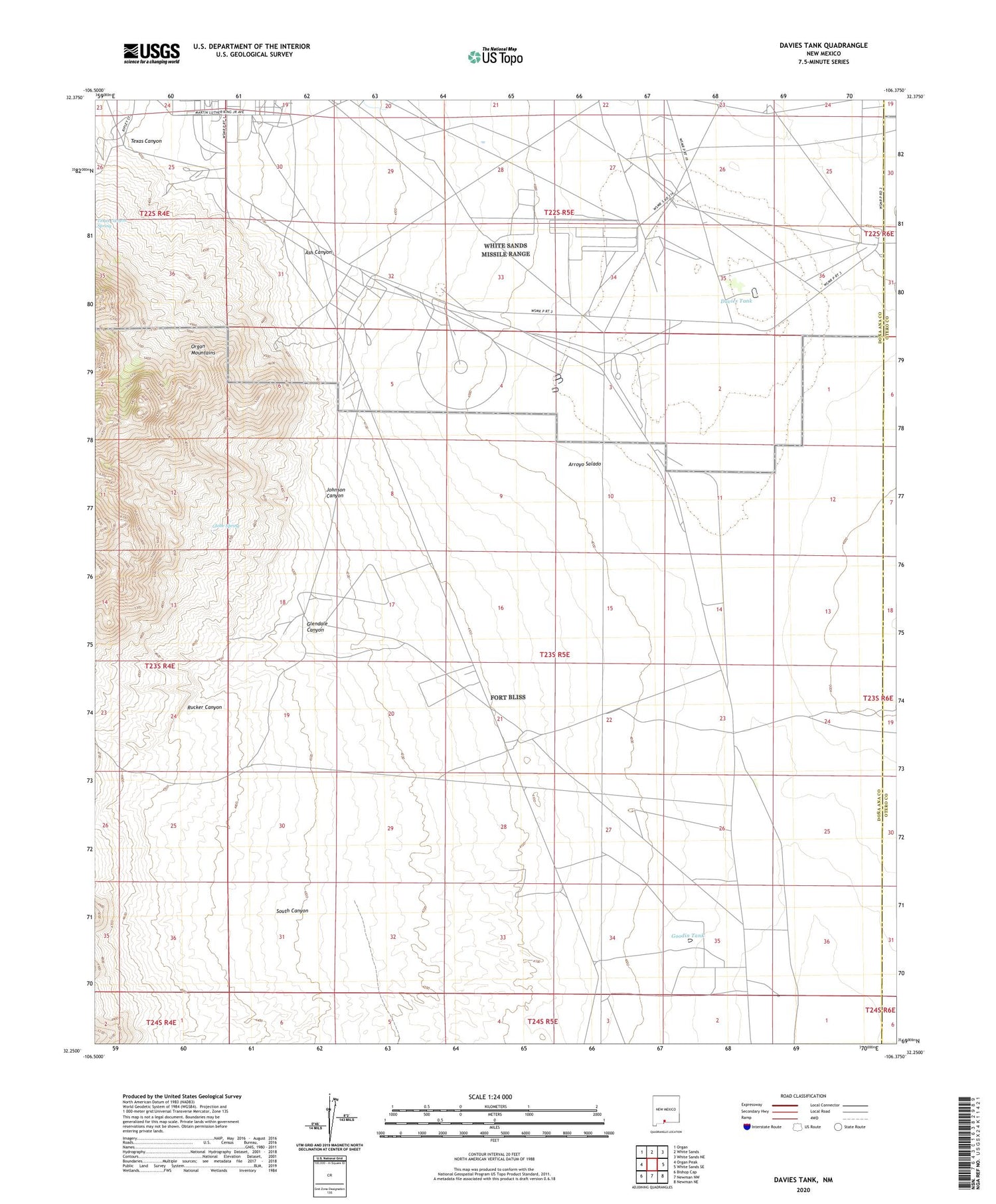
2020 topographic map quadrangle Davies Tank in the state of New Mexico. Scale: 1:24000. Based on the newly updated USGS 7.5' US Topo map series, this map is in the following counties: Doña Ana, Otero. The map contains contour data, water features, and other items you are used to seeing on USGS maps, but also has updated roads and other features. This is the next generation of topographic maps. Printed on high-quality waterproof paper with UV fade-resistant inks.
Quads adjacent to this one:
West: Organ Peak
Northwest: Organ
North: White Sands
Northeast: White Sands NE
East: White Sands SE
Southeast: Newman NE
South: Newman NW
Southwest: Bishop Cap
Contains the following named places: Arroyo Salado, Ash Canyon, Big Tanks, Condron Army Airfield, Davies Tank, Firing Line Road Water Well, Glendale Canyon, Globe Spring, Globe Spring Ranch, Globe Well, Goodin Tank, Goodin Well, Johnson Canyon, OS-2 Water Well, Os-3 Water Well, OS-4 Water Well, OS-4A Water Well, OS-5 Water Well, OS-6 Water Well, OS-7 Water Well, OS-8 Water Well, OS-9 Water Well, Rucker Canyon, South Canyon, T-11 Water Well, T-12 Water Well, T-15 Water Well, T-17 Water Well, Texas Canyon


