MyTopo
Bishop Cap New Mexico US Topo Map
Couldn't load pickup availability
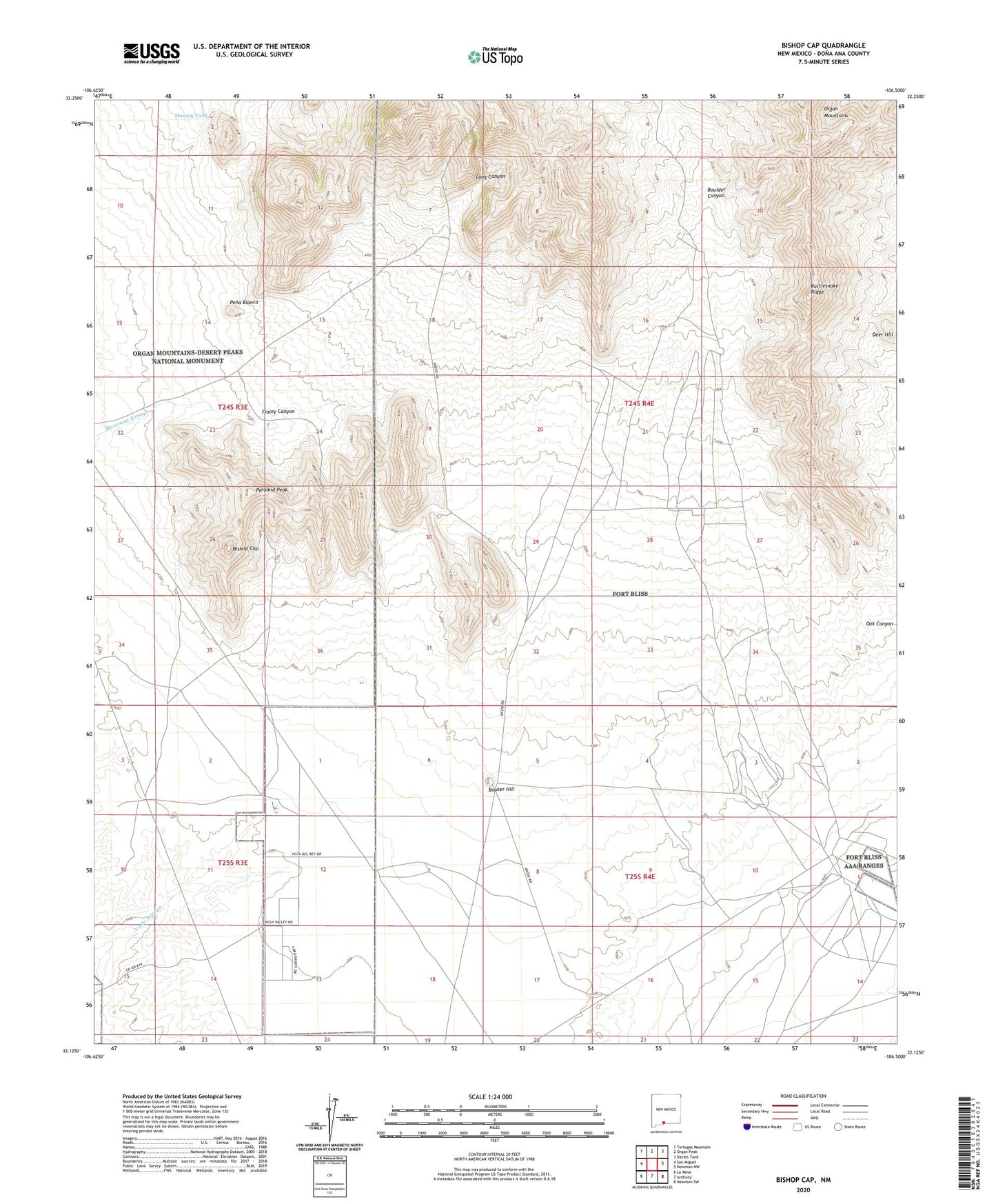
2023 topographic map quadrangle Bishop Cap in the state of New Mexico. Scale: 1:24000. Based on the newly updated USGS 7.5' US Topo map series, this map is in the following counties: Doña Ana. The map contains contour data, water features, and other items you are used to seeing on USGS maps, but also has updated roads and other features. This is the next generation of topographic maps. Printed on high-quality waterproof paper with UV fade-resistant inks.
Quads adjacent to this one:
West: San Miguel
Northwest: Tortugas Mountain
North: Organ Peak
Northeast: Davies Tank
East: Newman NW
Southeast: Newman SW
South: Anthony
Southwest: La Mesa
This map covers the same area as the classic USGS quad with code o32106b5.
Contains the following named places: 10108 Water Well, 10115 Water Well, 19 Water Well, 88072, Beasley Homestead, Bishop Cap, Bishops Cap Mine, Blue Star, Blue Star Prospect, Booker Hill, Boulder Canyon, Boyer Ranch, Brick Shale, Deer Hill, Dona Ana Range Camp, Finley Canyon, Grant Prospect, Herbert Mine, K 15 Water Well, K-14 Water Well, Long Canyon, Massey Tank, Number 1 Water Well, Pena Blanca, Pyramid Peak, Rattlesnake Ridge