MyTopo
Dawson New Mexico US Topo Map
Couldn't load pickup availability
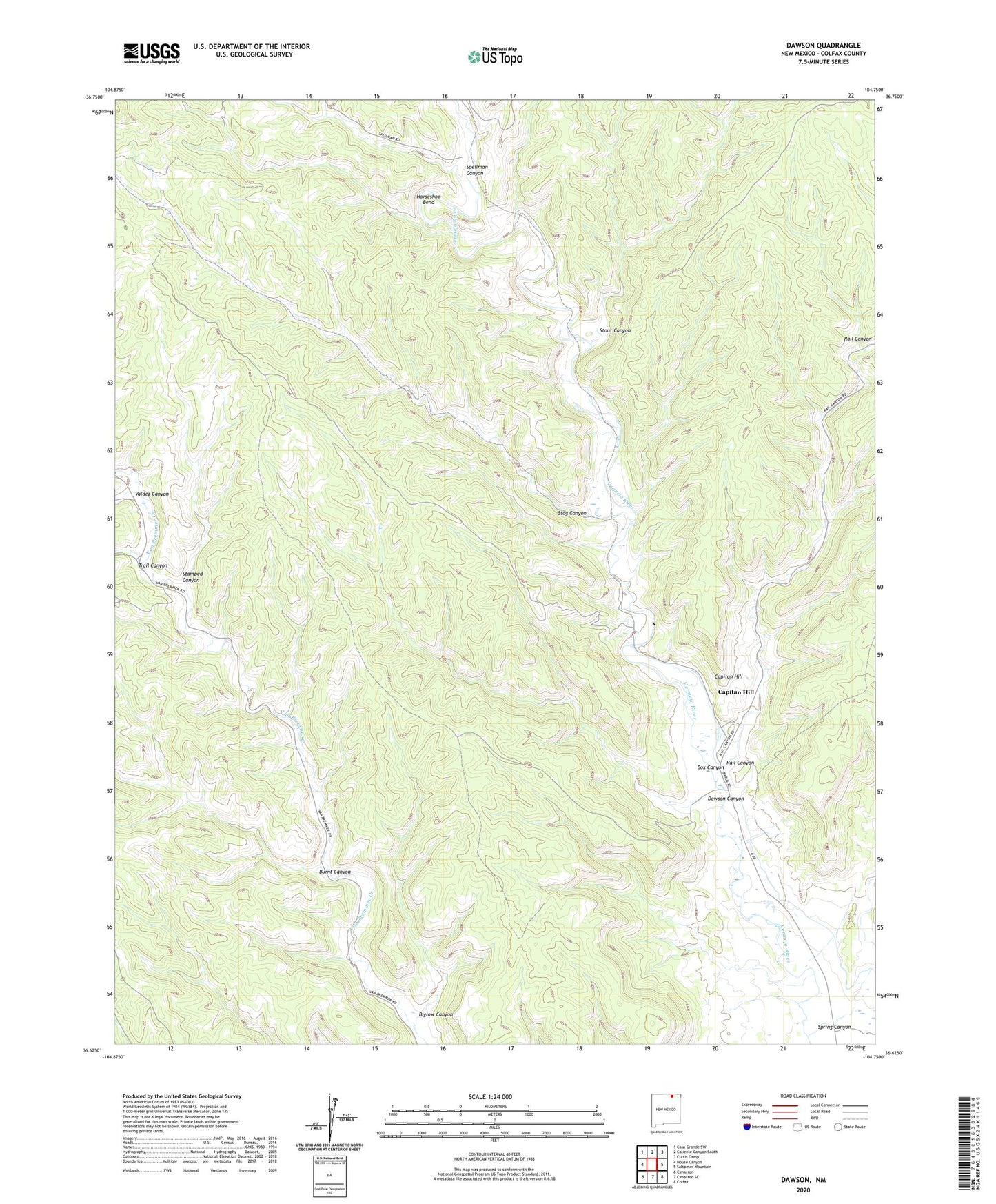
2020 topographic map quadrangle Dawson in the state of New Mexico. Scale: 1:24000. Based on the newly updated USGS 7.5' US Topo map series, this map is in the following counties: Colfax. The map contains contour data, water features, and other items you are used to seeing on USGS maps, but also has updated roads and other features. This is the next generation of topographic maps. Printed on high-quality waterproof paper with UV fade-resistant inks.
Quads adjacent to this one:
West: House Canyon
Northwest: Casa Grande SW
North: Caliente Canyon South
Northeast: Curtis Camp
East: Saltpeter Mountain
Southeast: Colfax
South: Cimarron SE
Southwest: Cimarron
Contains the following named places: Beaubien and Miranda Grant, Biglow Canyon, Box Canyon, Burnt Canyon, C S Cattle Company, Capitan Hill, Dawson, Dawson Canyon, Dawson Cemetery, Dawson Number 1 Mine, Dawson Number 10, Dawson Number 2 Mine, Dawson Number 3 Mine, Dawson Number 4 Mine, Dawson Number 5, Dawson Number 6, Dawson Number 7, Dawson Number 8 Mine, Dawson Number 9 Mine, Dawson Post Office, Dawson Weather Station, Horseshoe Bend, Lauretta Mine, Loretta, Rail Canyon, Speilman Canyon, Spring Canyon, Stag Canyon, Stamped Canyon, Stout Canyon, Trail Canyon, Valdez Canyon