MyTopo
Casa Grande SW New Mexico US Topo Map
Couldn't load pickup availability
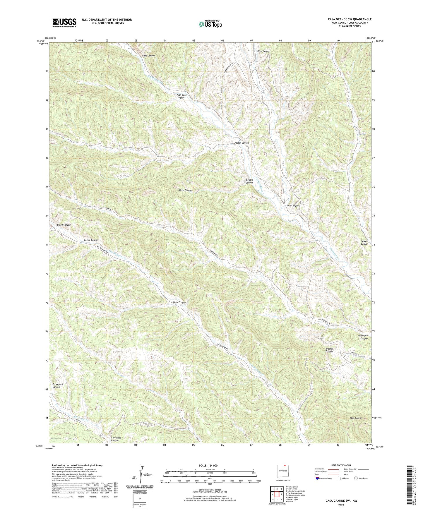
2023 topographic map quadrangle Casa Grande SW in the state of New Mexico. Scale: 1:24000. Based on the newly updated USGS 7.5' US Topo map series, this map is in the following counties: Colfax. The map contains contour data, water features, and other items you are used to seeing on USGS maps, but also has updated roads and other features. This is the next generation of topographic maps. Printed on high-quality waterproof paper with UV fade-resistant inks.
Quads adjacent to this one:
West: Van Bremmer Park
Northwest: Vermejo Park
North: Casa Grande
Northeast: Caliente Canyon North
East: Caliente Canyon South
Southeast: Dawson
South: House Canyon
Southwest: Abreu Canyon
This map covers the same area as the classic USGS quad with code o36104g8.
Contains the following named places: Broad Canyon, Corral Canyon, Graveyard Canyon, Griffin Canyon, Hells Canyon, Juan Baca Canyon, Pooler Canyon, Reed Canyon, Road Canyon, Van Houten Camp, Windmill Bremmer Camp, York Canyon, York Canyon Dam Number One, York Canyon Dam Number Three, York Canyon Dam Number Two, York Canyon Number 1