MyTopo
Saltpeter Mountain New Mexico US Topo Map
Couldn't load pickup availability
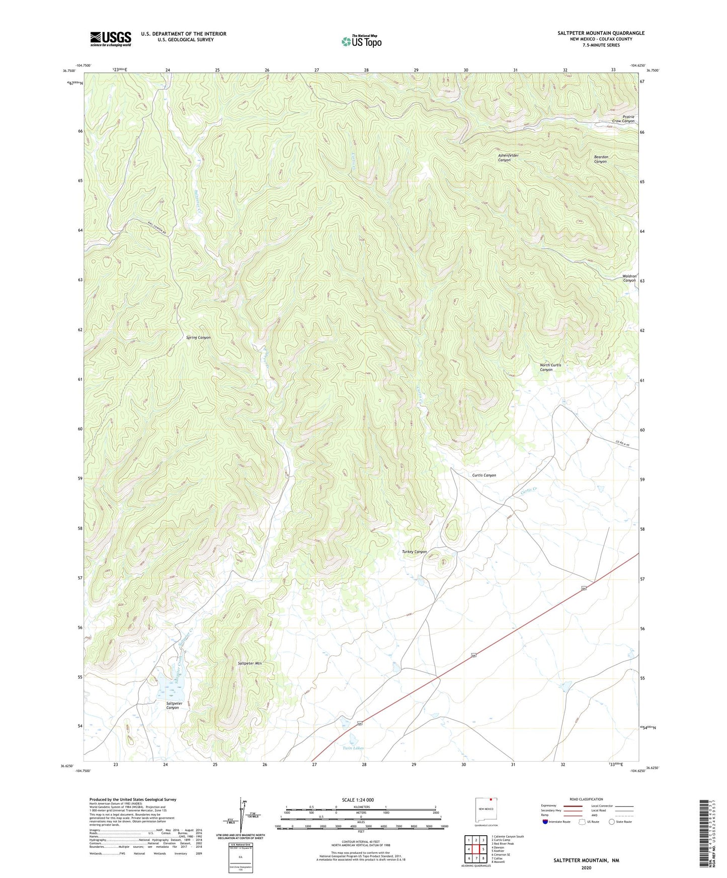
2023 topographic map quadrangle Saltpeter Mountain in the state of New Mexico. Scale: 1:24000. Based on the newly updated USGS 7.5' US Topo map series, this map is in the following counties: Colfax. The map contains contour data, water features, and other items you are used to seeing on USGS maps, but also has updated roads and other features. This is the next generation of topographic maps. Printed on high-quality waterproof paper with UV fade-resistant inks.
Quads adjacent to this one:
West: Dawson
Northwest: Caliente Canyon South
North: Curtis Camp
Northeast: Red River Peak
East: Koehler
Southeast: Maxwell
South: Colfax
Southwest: Cimarron SE
This map covers the same area as the classic USGS quad with code o36104f6.
Contains the following named places: Curtis Canyon, Koehler Mine, Koehler Number One, Koehler Number Three Mine, Koehler Number Two Mine, North Curtis Canyon, Saltpeter Canyon, Saltpeter Creek Site 1a Dam, Saltpeter Dam, Saltpeter Mountain, Turkey Canyon, Twin Lakes, Waldron Canyon