MyTopo
Day Canyon New Mexico US Topo Map
Couldn't load pickup availability
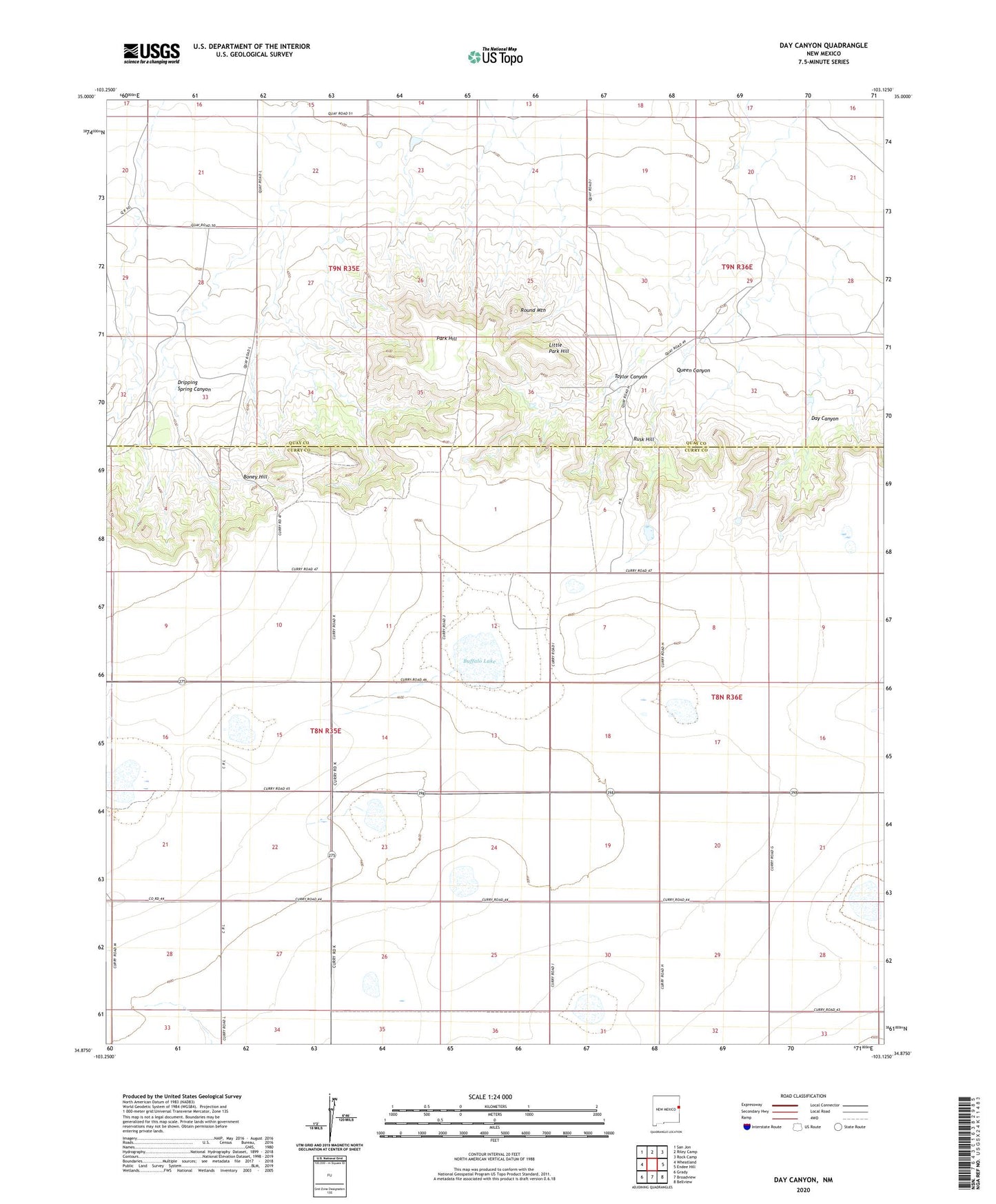
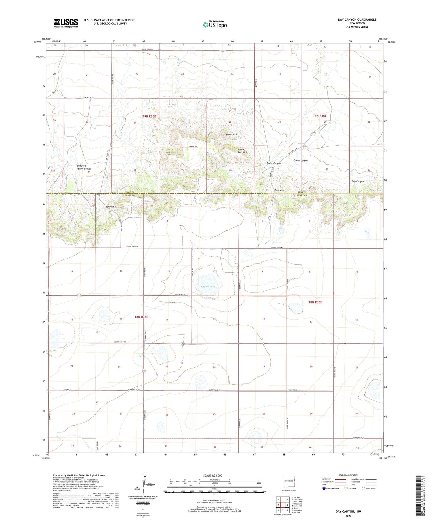
2020 topographic map quadrangle Day Canyon in the state of New Mexico. Scale: 1:24000. Based on the newly updated USGS 7.5' US Topo map series, this map is in the following counties: Curry, Quay. The map contains contour data, water features, and other items you are used to seeing on USGS maps, but also has updated roads and other features. This is the next generation of topographic maps. Printed on high-quality waterproof paper with UV fade-resistant inks.
Quads adjacent to this one:
West: Wheatland
Northwest: San Jon
North: Riley Camp
East: Endee Hill
Southeast: Bellview
South: Broadview
Southwest: Grady
Contains the following named places: 10200 Water Well, 10201 Water Well, 10203 Water Well, 10205 Water Well, 10209 Water Well, 10210 Water Well, 10247 Water Well, 10901 Water Well, Blackburn, Boney Hill, Buffalo Lake, Day Canyon, Dripping Spring Canyon, Little Park Hill, Park Hill, Queen Canyon, Round Mountain, Rusk, Rusk Hill, Seals, Taylor Canyon, Waltman