MyTopo
Riley Camp New Mexico US Topo Map
Couldn't load pickup availability
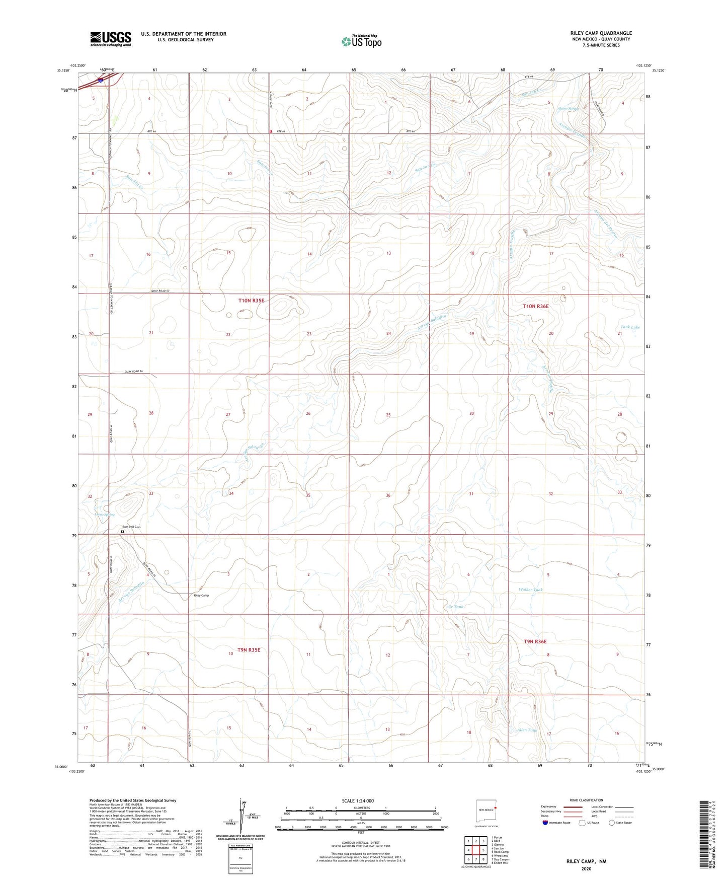
2023 topographic map quadrangle Riley Camp in the state of New Mexico. Scale: 1:24000. Based on the newly updated USGS 7.5' US Topo map series, this map is in the following counties: Quay. The map contains contour data, water features, and other items you are used to seeing on USGS maps, but also has updated roads and other features. This is the next generation of topographic maps. Printed on high-quality waterproof paper with UV fade-resistant inks.
Quads adjacent to this one:
West: San Jon
Northwest: Porter
North: Bard
Northeast: Glenrio
Southeast: Endee Hill
South: Day Canyon
Southwest: Wheatland
This map covers the same area as the classic USGS quad with code o35103a2.
Contains the following named places: 05200 Water Well, 05202 Water Well, 05203 Water Well, 05207 Water Well, 05209 Water Well, 05211 Water Well, 05213 Water Well, 05214 Water Well, 05216 Water Well, Alamo Spring, Allen, Allen Post Office, Allen Tank, Allen Well, Arroyo del Puerto, Arroyo Saladito, Arroyo Trujillo, Bard - Endee Fire District Station 1, Berrendo Windmill, Boot Hill Cemetery, Charley White Windmill, Creek Tank, Creek Windmill, Davidson Ranch, Durham Windmill, Fife Windmill, Haystack Windmill, Hill Windmill, Llano Spring, Mano Windmill, Morgan, Ok Windmill, Riley Camp, San Jon Creek, Tank Lake, Walker Tank, Walker Well, Wheat Windmill