
MyTopo
Des Moines New Mexico US Topo Map
Couldn't load pickup availability
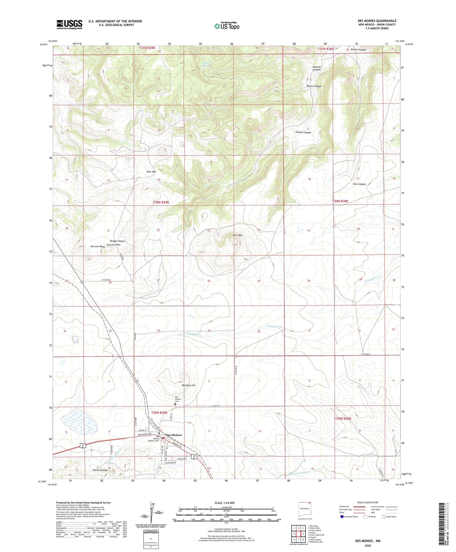
2020 topographic map quadrangle Des Moines in the state of New Mexico. Scale: 1:24000. Based on the newly updated USGS 7.5' US Topo map series, this map is in the following counties: Union. The map contains contour data, water features, and other items you are used to seeing on USGS maps, but also has updated roads and other features. This is the next generation of topographic maps. Printed on high-quality waterproof paper with UV fade-resistant inks.
Quads adjacent to this one:
West: Folsom
Northwest: Alps Mesa
North: Emery Peak
Northeast: Cross L Ranch
East: Cross L Ranch SW
Southeast: Weatherly Lake
South: Little Grande
Southwest: Capulin
Contains the following named places: 10305 Water Well, Allen Windmill, Brown Canyon, Burnt Canyon, Carr Mountain, Colomex Pit, Colorado and Southern Ballast Pit, Crow Windmill, Des Moines, Des Moines - Folsom Emergency Medical Services, Des Moines Catholic Cemetery, Des Moines Cemetery, Des Moines Elementary School, Des Moines Fire Department, Des Moines High School, Des Moines Post Office, Des Moines Weather Station, Dunchee Hill, First Baptist Mission, Fowler Canyon, Hen Windmill, Los Lujanes, Mitchel Canyon, Mitchel Springs, Ojo del Pinaveta Cemetery, Pachta Windmill, Purvine Hills, Purvine Mesa, Roberts Windmill, Twin Mountain, Village of Des Moines


