MyTopo
Cross L Ranch SW New Mexico US Topo Map
Couldn't load pickup availability
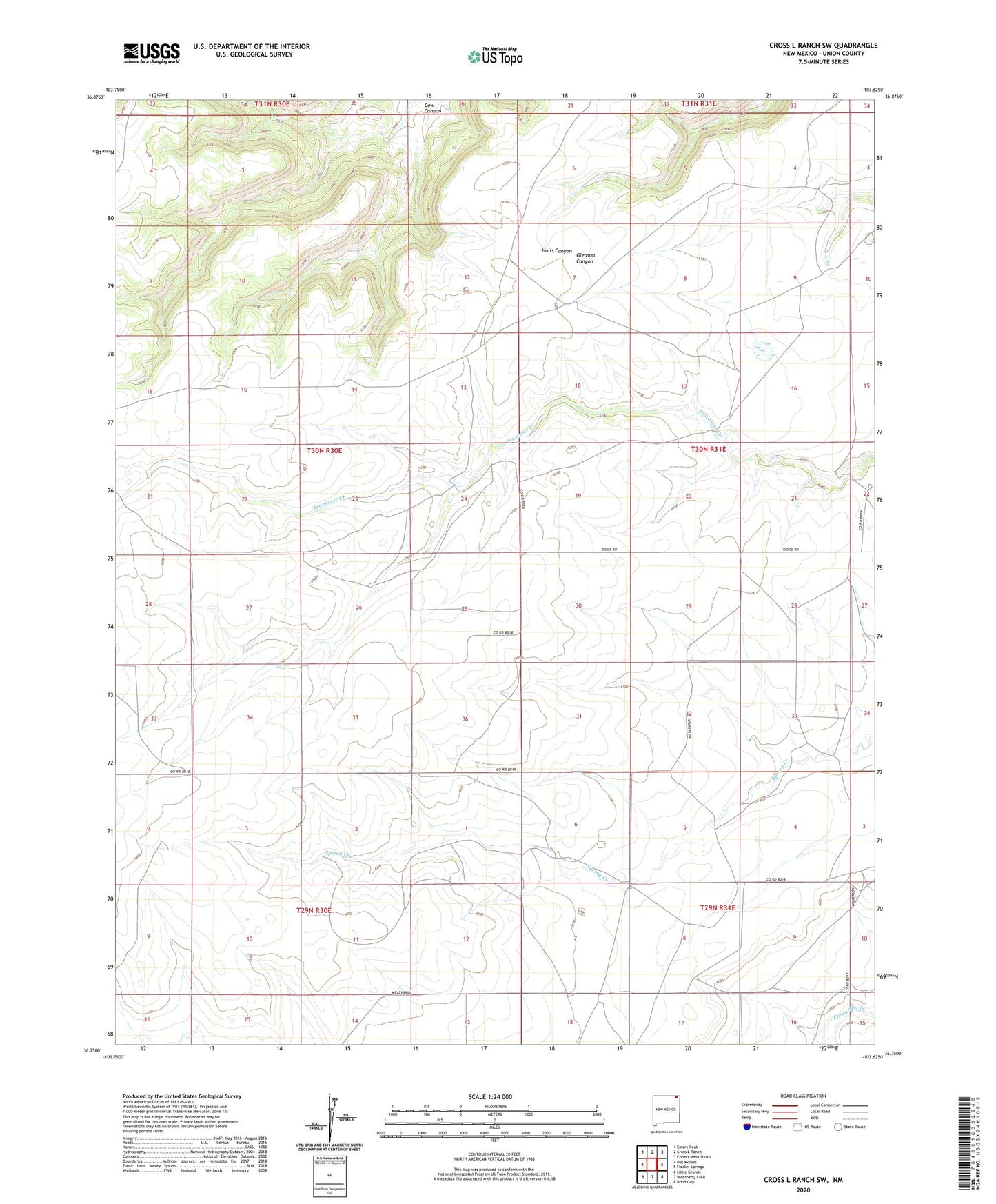
2023 topographic map quadrangle Cross L Ranch SW in the state of New Mexico. Scale: 1:24000. Based on the newly updated USGS 7.5' US Topo map series, this map is in the following counties: Union. The map contains contour data, water features, and other items you are used to seeing on USGS maps, but also has updated roads and other features. This is the next generation of topographic maps. Printed on high-quality waterproof paper with UV fade-resistant inks.
Quads adjacent to this one:
West: Des Moines
Northwest: Emery Peak
North: Cross L Ranch
Northeast: Cobert Mesa South
East: Fiddler Springs
Southeast: Blind Gap
South: Weatherly Lake
Southwest: Little Grande
This map covers the same area as the classic USGS quad with code o36103g6.
Contains the following named places: Baker Windmill, Fleming Windmill, Twin Windmills, Wilkinson