MyTopo
Weatherly Lake New Mexico US Topo Map
Couldn't load pickup availability
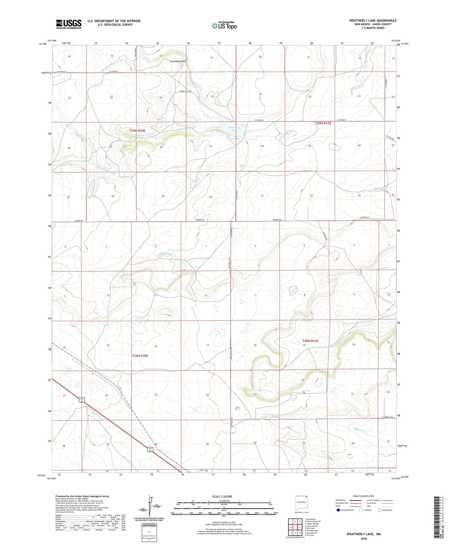
2023 topographic map quadrangle Weatherly Lake in the state of New Mexico. Scale: 1:24000. Based on the newly updated USGS 7.5' US Topo map series, this map is in the following counties: Union. The map contains contour data, water features, and other items you are used to seeing on USGS maps, but also has updated roads and other features. This is the next generation of topographic maps. Printed on high-quality waterproof paper with UV fade-resistant inks.
Quads adjacent to this one:
West: Little Grande
Northwest: Des Moines
North: Cross L Ranch SW
Northeast: Fiddler Springs
East: Blind Gap
Southeast: Grenville
South: Grenville SW
Southwest: Cow Mountain
Contains the following named places: Black Springs, Brown, Hittson, Lonesome Rock, North Branch Corrumpa Creek, South Branch Corrumpa Creek, Weatherly Dam, Weatherly Lake, Weatherly Ranch, ZIP Code: 88418