MyTopo
Desert SE New Mexico US Topo Map
Couldn't load pickup availability
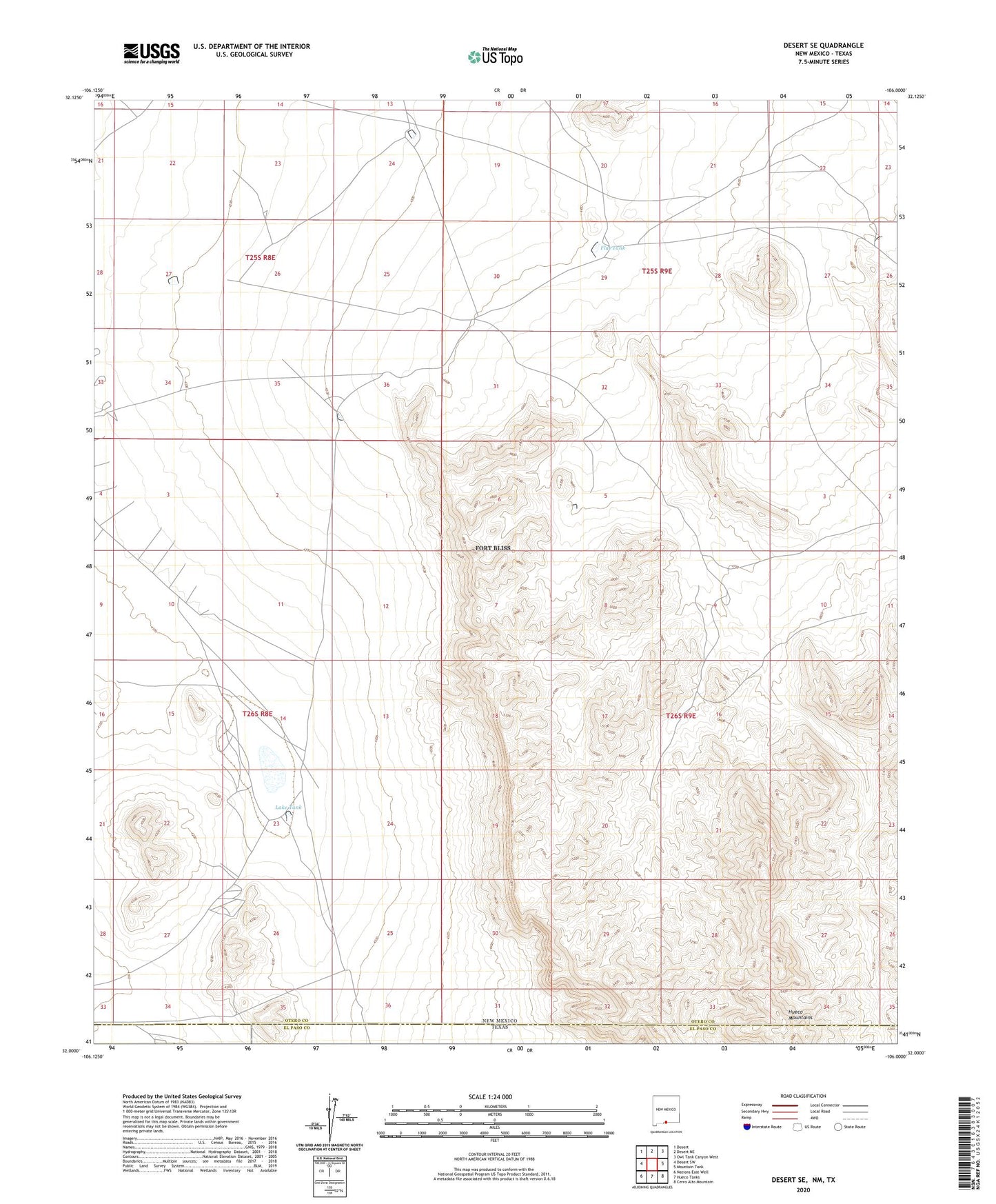
2023 topographic map quadrangle Desert SE in the state of New Mexico. Scale: 1:24000. Based on the newly updated USGS 7.5' US Topo map series, this map is in the following counties: Otero, El Paso. The map contains contour data, water features, and other items you are used to seeing on USGS maps, but also has updated roads and other features. This is the next generation of topographic maps. Printed on high-quality waterproof paper with UV fade-resistant inks.
Quads adjacent to this one:
West: Desert SW
Northwest: Desert
North: Desert NE
Northeast: Owl Tank Canyon West
East: Mountain Tank
Southeast: Cerro Alto Mountain
South: Hueco Tanks
Southwest: Nations East Well
Contains the following named places: Chaparral Tank, Charley Tank, Coyote Tank, Flat Tank, Lake Tank, New Tank