MyTopo
Hueco Tanks Texas US Topo Map
Couldn't load pickup availability
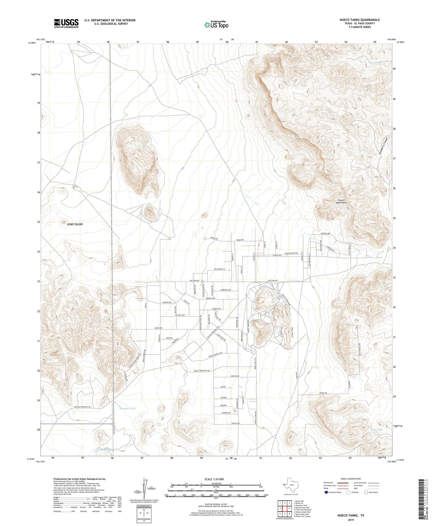
2022 topographic map quadrangle Hueco Tanks in the state of Texas. Scale: 1:24000. Based on the newly updated USGS 7.5' US Topo map series, this map is in the following counties: El Paso. The map contains contour data, water features, and other items you are used to seeing on USGS maps, but also has updated roads and other features. This is the next generation of topographic maps. Printed on high-quality waterproof paper with UV fade-resistant inks.
Quads adjacent to this one:
West: Nations East Well
Northwest: Desert SW
North: Desert SE
Northeast: Mountain Tank
East: Cerro Alto Mountain
Southeast: Phone Line Canyon
South: Helms West Well
Southwest: Nations South Well
This map covers the same area as the classic USGS quad with code o31106h1.
Contains the following named places: Coyote Tank, Deer Tank, Eighteen Tank, Hackberry Canyon, Hidden Tank, Hueco Mountain Estates Number 1 Colonia, Hueco Mountain Estates Number 2 Colonia, Hueco Mountain Estates Number 3 Colonia, Hueco Mountain Estates Number 4 Colonia, Hueco Mountain Estates Number 5 Colonia, Hueco Mountain Estates Number 6 Colonia, Hueco Mountain Estates Number 7 Colonia, Hueco Mountain Estates Number 8 Colonia, Hueco Mountains, Hueco Tanks, Hueco Tanks State Historical Park, Hueco Tanks State Historical Park Trail, Jarilla Tank, Kerby Tank, Mesquite Tank, Ramons Tank, Ross Tank, Ysleta del Sur Pueblo