MyTopo
Elk Mountain New Mexico US Topo Map
Couldn't load pickup availability
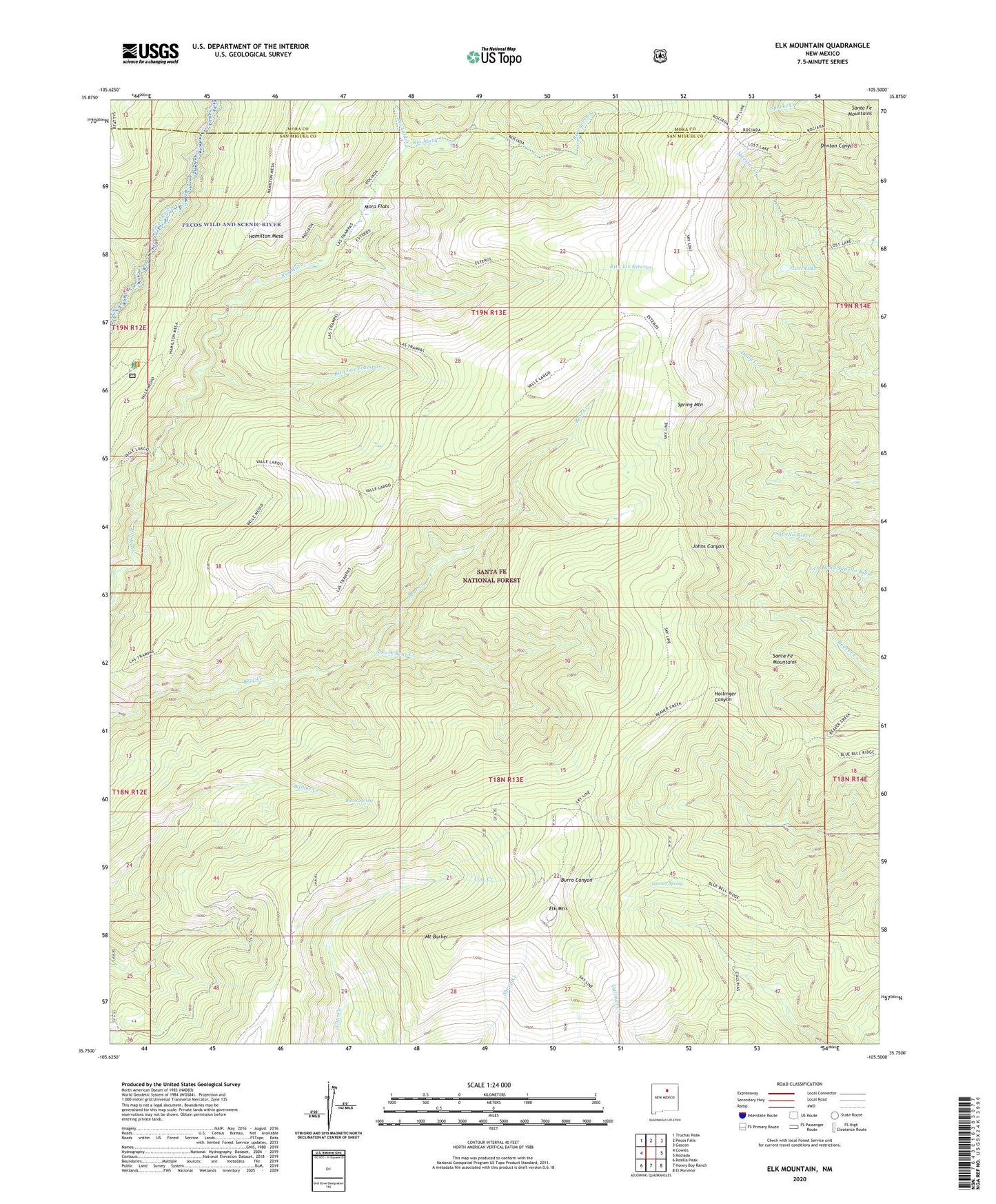
2020 topographic map quadrangle Elk Mountain in the state of New Mexico. Scale: 1:24000. Based on the newly updated USGS 7.5' US Topo map series, this map is in the following counties: San Miguel, Mora. The map contains contour data, water features, and other items you are used to seeing on USGS maps, but also has updated roads and other features. This is the next generation of topographic maps. Printed on high-quality waterproof paper with UV fade-resistant inks.
Quads adjacent to this one:
West: Cowles
Northwest: Truchas Peak
North: Pecos Falls
Northeast: Gascon
East: Rociada
Southeast: El Porvenir
South: Honey Boy Ranch
Southwest: Rosilla Peak
Contains the following named places: Burnt Spring, Elk Mountain, Iron Gate Recreation Site, Lost Lake, Mora Flats, Mount Barker, Noisy Brook, Pecos Wild and Scenic River, Rio Valdez, Rito del Oso, Rito Las Trampas, Rito los Esteros, Santa Fe Mountains, South Fork Bear Creek, Spring Mountain, Valle Alto, Valle Largo, Valle Medio, Vegas Bonita, Weener Spring