MyTopo
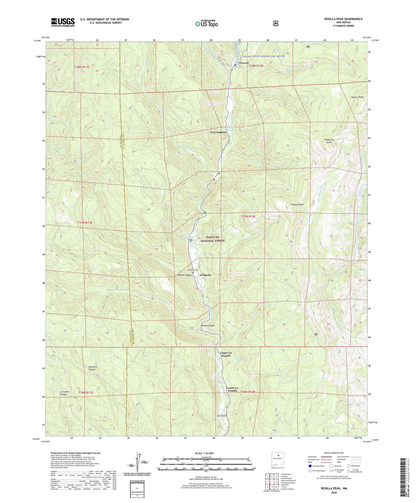
Rosilla Peak New Mexico US Topo Map
Couldn't load pickup availability
Also explore the Rosilla Peak Forest Service Topo of this same quad for updated USFS data
2023 topographic map quadrangle Rosilla Peak in the state of New Mexico. Scale: 1:24000. Based on the newly updated USGS 7.5' US Topo map series, this map is in the following counties: San Miguel, Santa Fe. The map contains contour data, water features, and other items you are used to seeing on USGS maps, but also has updated roads and other features. This is the next generation of topographic maps. Printed on high-quality waterproof paper with UV fade-resistant inks.
Quads adjacent to this one:
West: McClure Reservoir
Northwest: Aspen Basin
North: Cowles
Northeast: Elk Mountain
East: Honey Boy Ranch
Southeast: Lower Colonias
South: Pecos
Southwest: Glorieta
This map covers the same area as the classic USGS quad with code o35105f6.
Contains the following named places: Alamosa Spring, Bert Clancy Recreation Site, Brush Ranch, Camp La Salle, Chaperito Knob, Cow Creek Campground, Dalton Canyon, Dalton Picnic Area, Davis Creek, Dry Gulch, El Macho, El Macho Cemetery, Field Tract Campground, Gould and Thomas Mine, Hidden Valley Ranch, Holy Ghost Creek, Holy Ghost Summer Home Area, Indian Creek, Jones Mine, Lower La Posada, Macho Canyon, Martin Ranch, Pecos Ranger District, Rito Chaperito, Rito de la Osha, Rosilla Peak, San Miguel County Fire District Pecos Canyon Fire Department, Sawyer Creek, Tererro, Tererro Post Office, Tres Lagunas, Upper La Posada, Viveash Mesa, Windy Bridge Recreation Site