MyTopo
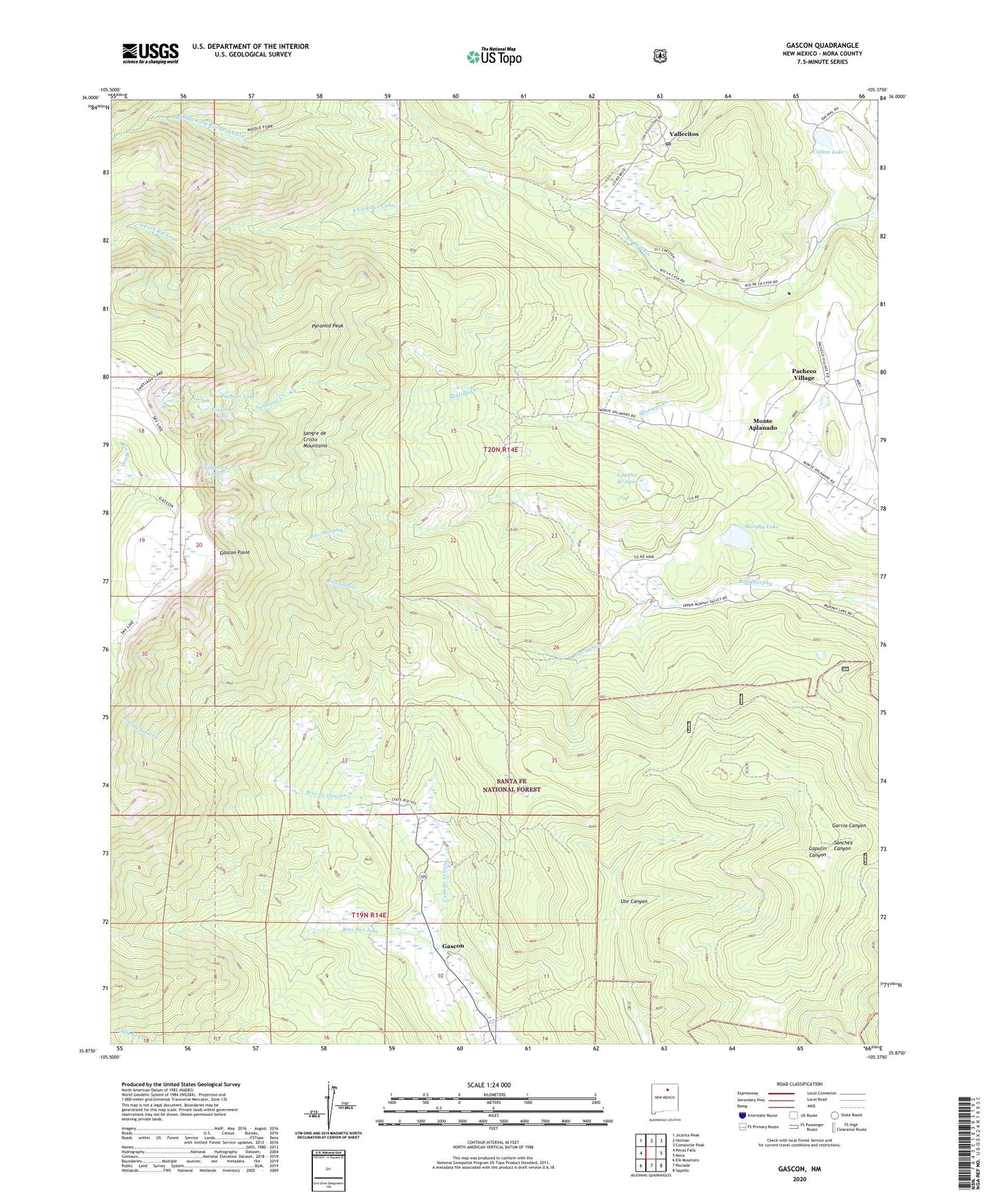
Gascon New Mexico US Topo Map
Couldn't load pickup availability
Also explore the Gascon Forest Service Topo of this same quad for updated USFS data
2023 topographic map quadrangle Gascon in the state of New Mexico. Scale: 1:24000. Based on the newly updated USGS 7.5' US Topo map series, this map is in the following counties: Mora. The map contains contour data, water features, and other items you are used to seeing on USGS maps, but also has updated roads and other features. This is the next generation of topographic maps. Printed on high-quality waterproof paper with UV fade-resistant inks.
Quads adjacent to this one:
West: Pecos Falls
Northwest: Jicarita Peak
North: Holman
Northeast: Comanche Peak
East: Mora
Southeast: Sapello
South: Rociada
Southwest: Elk Mountain
This map covers the same area as the classic USGS quad with code o35105h4.
Contains the following named places: Camp Davis, Canada Lovato, Collins Lake, Enchanted Lake, Gascon, Gascon Point, Gascon Post Office, Gascon Trail, Gascon Weather Station, Laguna de Agua, Middle Fork Rio de la Casa, Monte Aplanado, Morphy Dam, Morphy Lake, Morphy Lake State Park, North Fork Rio la Casa, Pacheco Lake, Pacheco Village, Pyramid Peak, Rito de Gascon, Rito Garcia, Santiago Lake, Santo Nino Chapel, South Fork Rio Casa, Ute Canyon, Vallecitos, Vallecitos Post Office