MyTopo
Emery Peak New Mexico US Topo Map
Couldn't load pickup availability
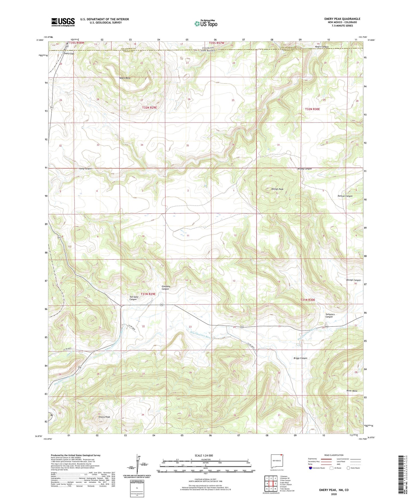
2020 topographic map quadrangle Emery Peak in the states of New Mexico, Colorado. Scale: 1:24000. Based on the newly updated USGS 7.5' US Topo map series, this map is in the following counties: Union, Las Animas. The map contains contour data, water features, and other items you are used to seeing on USGS maps, but also has updated roads and other features. This is the next generation of topographic maps. Printed on high-quality waterproof paper with UV fade-resistant inks.
Quads adjacent to this one:
West: Alps Mesa
Northwest: Branson
North: Branson SE
Northeast: Pine Canyon
East: Cross L Ranch
Southeast: Cross L Ranch SW
South: Des Moines
Southwest: Folsom
Contains the following named places: 10136 Water Well, 10138 Water Well, Alps, Briggs Canyon, Brown Reservoir Dam, Devoys Canyon, Devoys Peak, Emery Gap, Emery Gap Post Office, Emery Peak, Gleasons Canyon, Johns and Gleason North Ditch, Madison, Madison Post Office, Negro Canyon, Negro Mesa, Oak Creek, River Mesa, Sumpters Canyon, Toll Gate Canyon, Vandaveer