MyTopo
Field New Mexico US Topo Map
Couldn't load pickup availability
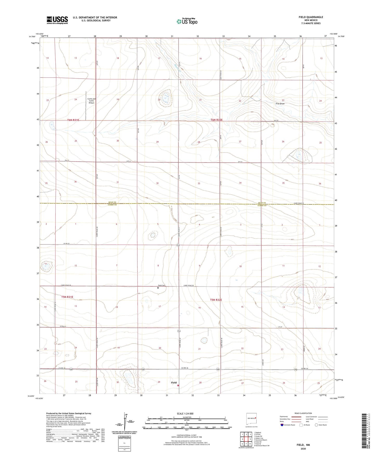
2023 topographic map quadrangle Field in the state of New Mexico. Scale: 1:24000. Based on the newly updated USGS 7.5' US Topo map series, this map is in the following counties: Quay, Curry. The map contains contour data, water features, and other items you are used to seeing on USGS maps, but also has updated roads and other features. This is the next generation of topographic maps. Printed on high-quality waterproof paper with UV fade-resistant inks.
Quads adjacent to this one:
West: Weber City
Northwest: Ragland
North: Forrest
Northeast: Grady SW
East: Hammond Ranch
Southeast: Hammond Ranch SW
South: Field SE
Southwest: Field SW
This map covers the same area as the classic USGS quad with code o34103f5.
Contains the following named places: 10290 Water Well, 10291 Water Well, 10293 Water Well, 10403 Water Well, 10404 Water Well, 10405 Water Well, 10406 Water Well, 10407 Water Well, 10408 Water Well, 10409 Water Well, 10410 Water Well, 10411 Water Well, 10412 Water Well, 10413 Water Well, 10513 Water Well, 10515 Water Well, 10519 Water Well, 10520 Water Well, 10521 Water Well, 10524 Water Well, 10525 Water Well, 10750 Water Well, 10751 Water Well, 10785 Water Well, Blanco Creek, Breen Well, Cornet Well, Curtis and Curtis Airport, Dunn, East Well, Field, Field Cemetery, Field Post Office, Field Volunteer Fire Department, Grandmother Well, Greathouse Well, Hall, Keeler Well, Odell Well, Reagen Well