MyTopo
Foster Ranch New Mexico US Topo Map
Couldn't load pickup availability
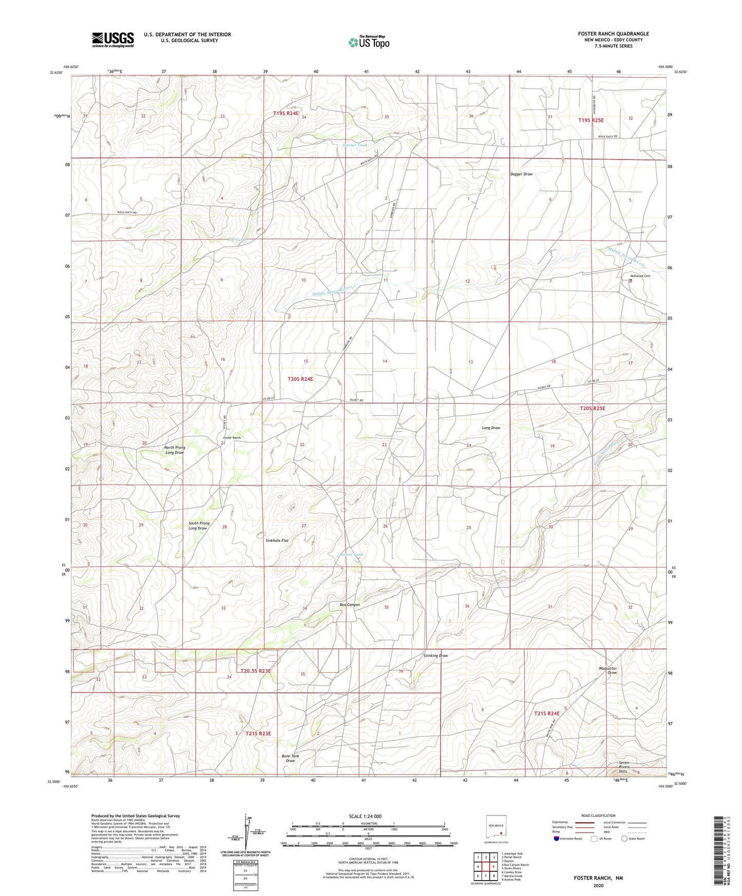
2023 topographic map quadrangle Foster Ranch in the state of New Mexico. Scale: 1:24000. Based on the newly updated USGS 7.5' US Topo map series, this map is in the following counties: Eddy. The map contains contour data, water features, and other items you are used to seeing on USGS maps, but also has updated roads and other features. This is the next generation of topographic maps. Printed on high-quality waterproof paper with UV fade-resistant inks.
Quads adjacent to this one:
West: Box Canyon Ranch
Northwest: Antelope Sink
North: Parish Ranch
Northeast: Dayton
East: Seven Rivers
Southeast: Azotea Peak
South: Martha Creek
Southwest: Cawley Draw
This map covers the same area as the classic USGS quad with code o32104e5.
Contains the following named places: Black Muley Mill, Bone Tank Draw, Box Canyon, C C Tank, Dagger Draw, East Well, Foster Ranch, Horner Tank, Howell Ranch, Klendenen Well, Knowles Place, Lee Ranch, Long Draw, McDonald Cemetery, North Prong Long Draw, Oil City Well, Old Ball Well, Rock House, Round Tank, Round Tank Well, Sinkhole Flat, South Prong Long Draw, Stinking Draw, Wadcutter Draw