MyTopo
Martha Creek New Mexico US Topo Map
Couldn't load pickup availability
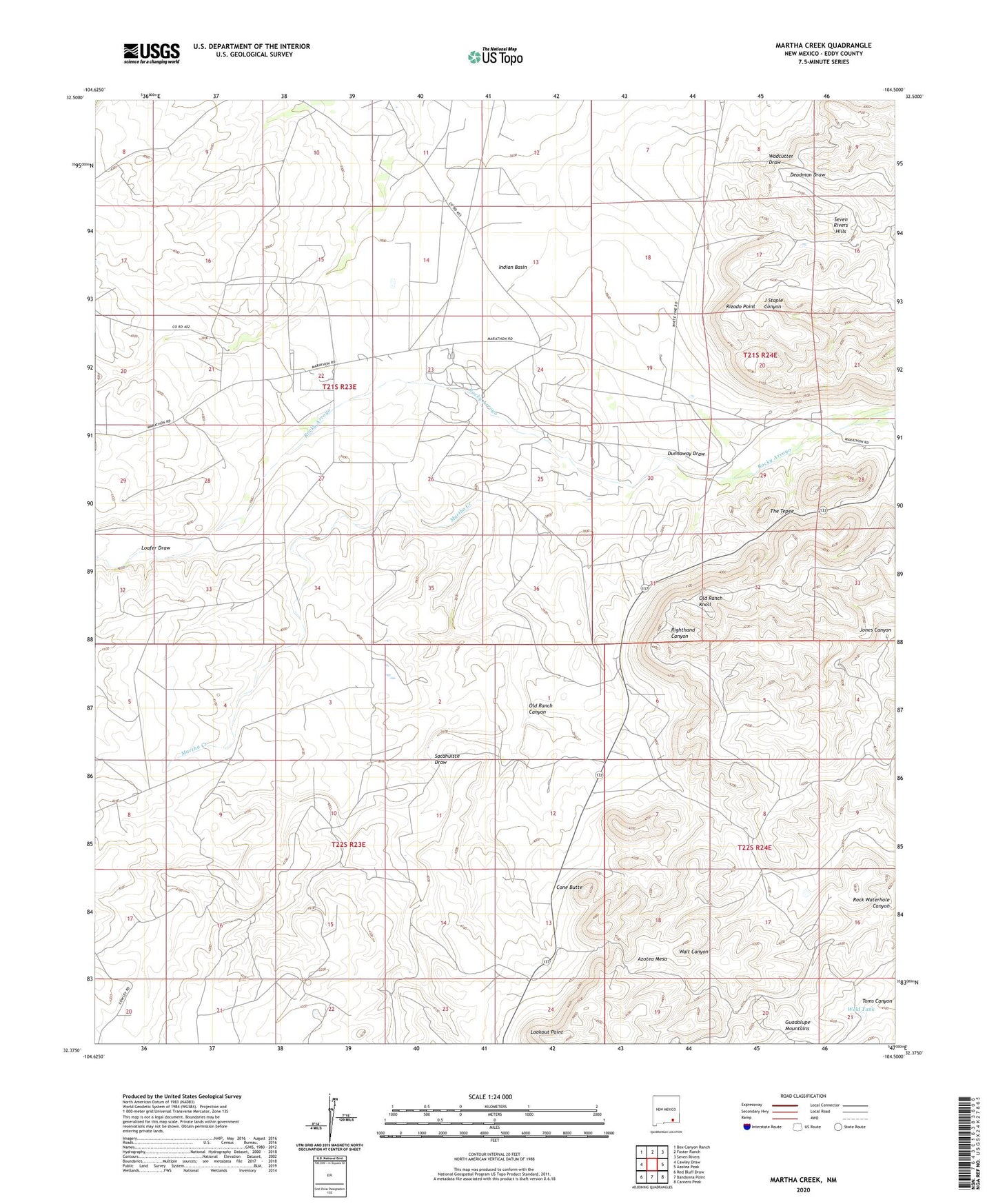
2023 topographic map quadrangle Martha Creek in the state of New Mexico. Scale: 1:24000. Based on the newly updated USGS 7.5' US Topo map series, this map is in the following counties: Eddy. The map contains contour data, water features, and other items you are used to seeing on USGS maps, but also has updated roads and other features. This is the next generation of topographic maps. Printed on high-quality waterproof paper with UV fade-resistant inks.
Quads adjacent to this one:
West: Cawley Draw
Northwest: Box Canyon Ranch
North: Foster Ranch
Northeast: Seven Rivers
East: Azotea Peak
Southeast: Carnero Peak
South: Bandanna Point
Southwest: Red Bluff Draw
This map covers the same area as the classic USGS quad with code o32104d5.
Contains the following named places: Cone Butte, Dunnaway Draw, Indian Basin, Indian Basin Plant, Jones Canyon, Jones Ranch, Loafer Draw, Lookout Point, Martha Creek, Mendoza Ranch, Old Ranch Canyon, Old Ranch Knoll, Polk Ranch, Righthand Well, Rizado Point, Sacahuiste Draw, Smith Ranch, The Tepee, Weld Tank