MyTopo
Gardner Peak New Mexico US Topo Map
Couldn't load pickup availability
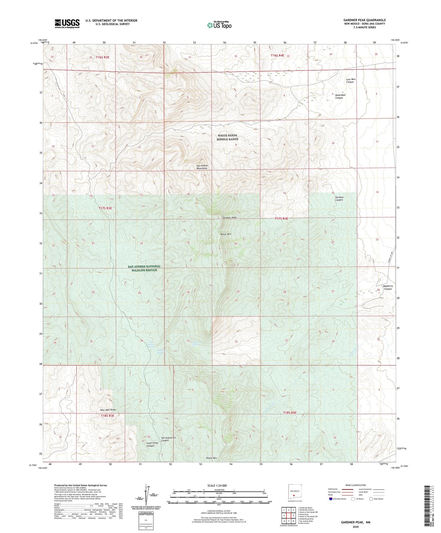
2023 topographic map quadrangle Gardner Peak in the state of New Mexico. Scale: 1:24000. Based on the newly updated USGS 7.5' US Topo map series, this map is in the following counties: Doña Ana. The map contains contour data, water features, and other items you are used to seeing on USGS maps, but also has updated roads and other features. This is the next generation of topographic maps. Printed on high-quality waterproof paper with UV fade-resistant inks.
Quads adjacent to this one:
West: Fleck Draw
Northwest: Hembrillo Basin
North: Hembrillo Canyon
Northeast: Heart of the Sands NW
East: Heart of the Sands SW
Southeast: Lake Lucero
South: San Andres Peak
Southwest: Goldenburg Draw
This map covers the same area as the classic USGS quad with code o32106g5.
Contains the following named places: Anderegg Ranch Headquarters, Andrecito, Baird Ranch, Block Mountain, Brock Tank, Crawford Spring, Dead Man Canyon, Gardner Canyon, Gardner Peak, Green Crawford, Lead Camp Canyon, Lost Man Canyon, Mayberry Canyon, Mayberry Spring, New Well, Onate Mountain, San Adrecito Spring, San Andrecito Canyon