MyTopo
Hembrillo Canyon New Mexico US Topo Map
Couldn't load pickup availability
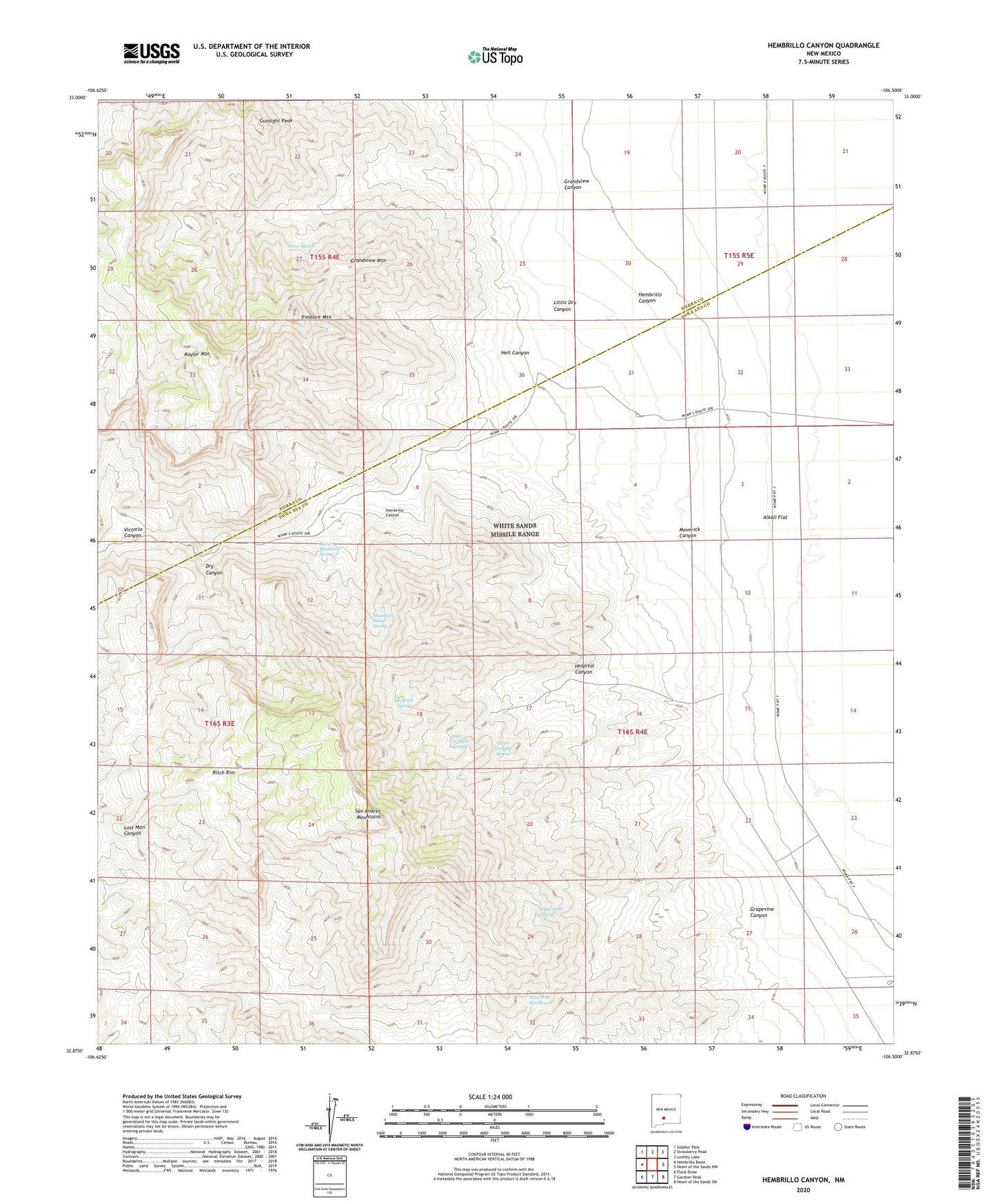
2023 topographic map quadrangle Hembrillo Canyon in the state of New Mexico. Scale: 1:24000. Based on the newly updated USGS 7.5' US Topo map series, this map is in the following counties: Doña Ana, Sierra. The map contains contour data, water features, and other items you are used to seeing on USGS maps, but also has updated roads and other features. This is the next generation of topographic maps. Printed on high-quality waterproof paper with UV fade-resistant inks.
Quads adjacent to this one:
West: Hembrillo Basin
Northwest: Sulphur Pass
North: Strawberry Peak
Northeast: Lumley Lake
East: Heart of the Sands NW
Southeast: Heart of the Sands SW
South: Gardner Peak
Southwest: Fleck Draw
This map covers the same area as the classic USGS quad with code o32106h5.
Contains the following named places: Doctors Well, Dry Canyon, Four Troughs Spring, Grandview, Grandview Canyon, Grandview Mountain, Grapevine Canyon, Greenback Mine, Gunsight Peak, Hell Canyon, Hembrillo, Hembrillo Canyon, Hospital Canyon, Hospital Spring, Kaylor Mountain, Little Dry Canyon, Lower Hembrillo Spring, Maverick Canyon, Mountain Sheep Spring, Parker Deposit, Pioneer Jr Mine, Pioneer Mine, Red Rock, Ritch Ranch, Ritch Rim, Stone Spring, Three Troughs Spring, Treasure Mountain, Victorio Canyon, White Rock Spring, Wild Mule Spring