MyTopo
Greendailey Canyon New Mexico US Topo Map
Couldn't load pickup availability
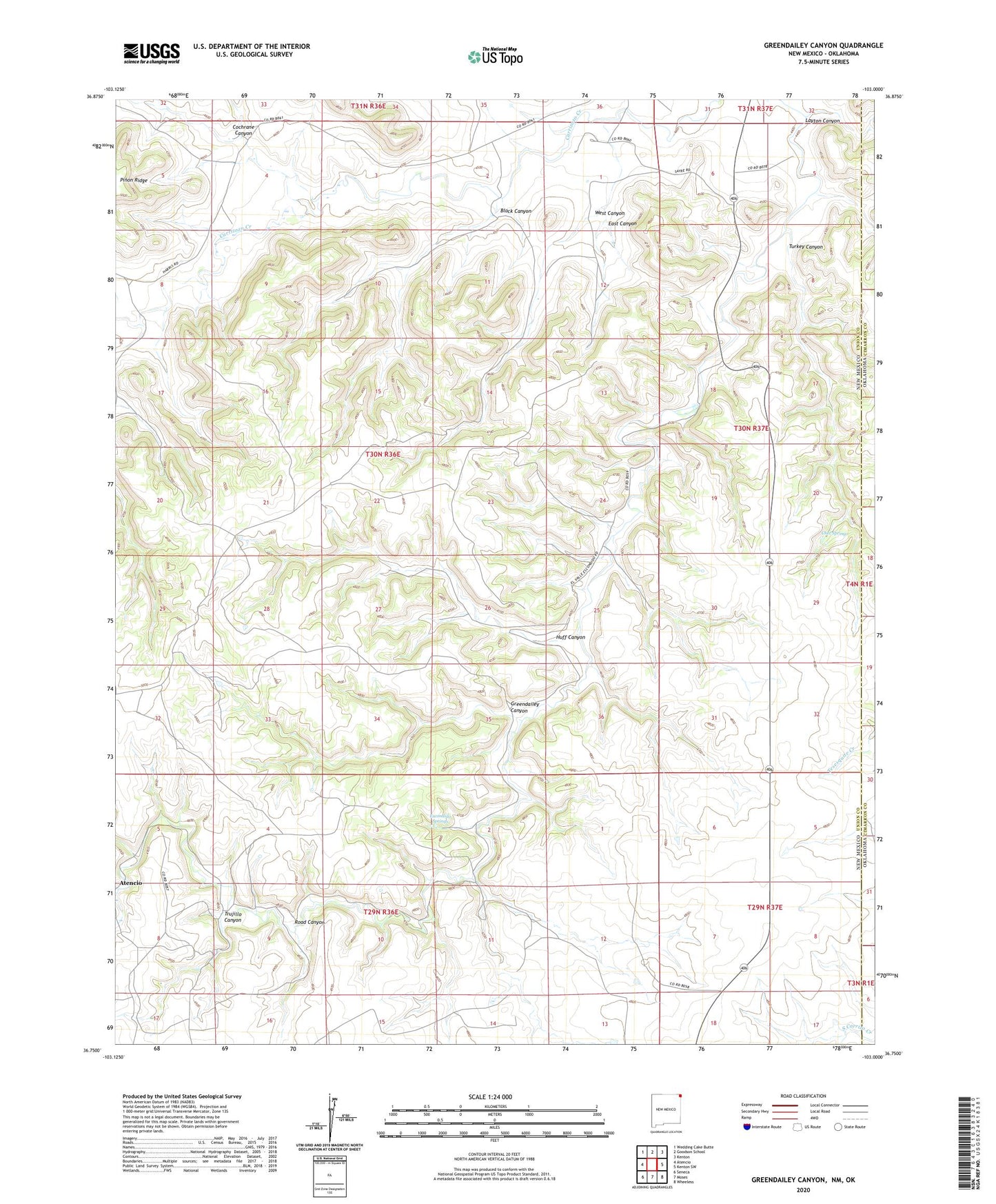
2023 topographic map quadrangle Greendailey Canyon in the state of New Mexico. Scale: 1:24000. Based on the newly updated USGS 7.5' US Topo map series, this map is in the following counties: Union, Cimarron. The map contains contour data, water features, and other items you are used to seeing on USGS maps, but also has updated roads and other features. This is the next generation of topographic maps. Printed on high-quality waterproof paper with UV fade-resistant inks.
Quads adjacent to this one:
West: Atencio
Northwest: Wedding Cake Butte
North: Goodson School
Northeast: Kenton
East: Kenton SW
Southeast: Wheeless
South: Moses
Southwest: Seneca
Contains the following named places: Black Canyon, Chet Springs, Cochrane Canyon, East Canyon, Escondido Springs, Greendailey Canyon, Huff Canyon, Layton Canyon, Miller, Morledge Windmill, Pinon Windmill, South Carrizo Creek, Trujillo Canyon, Turkey Canyon, West Canyon