MyTopo
Goodson School New Mexico US Topo Map
Couldn't load pickup availability
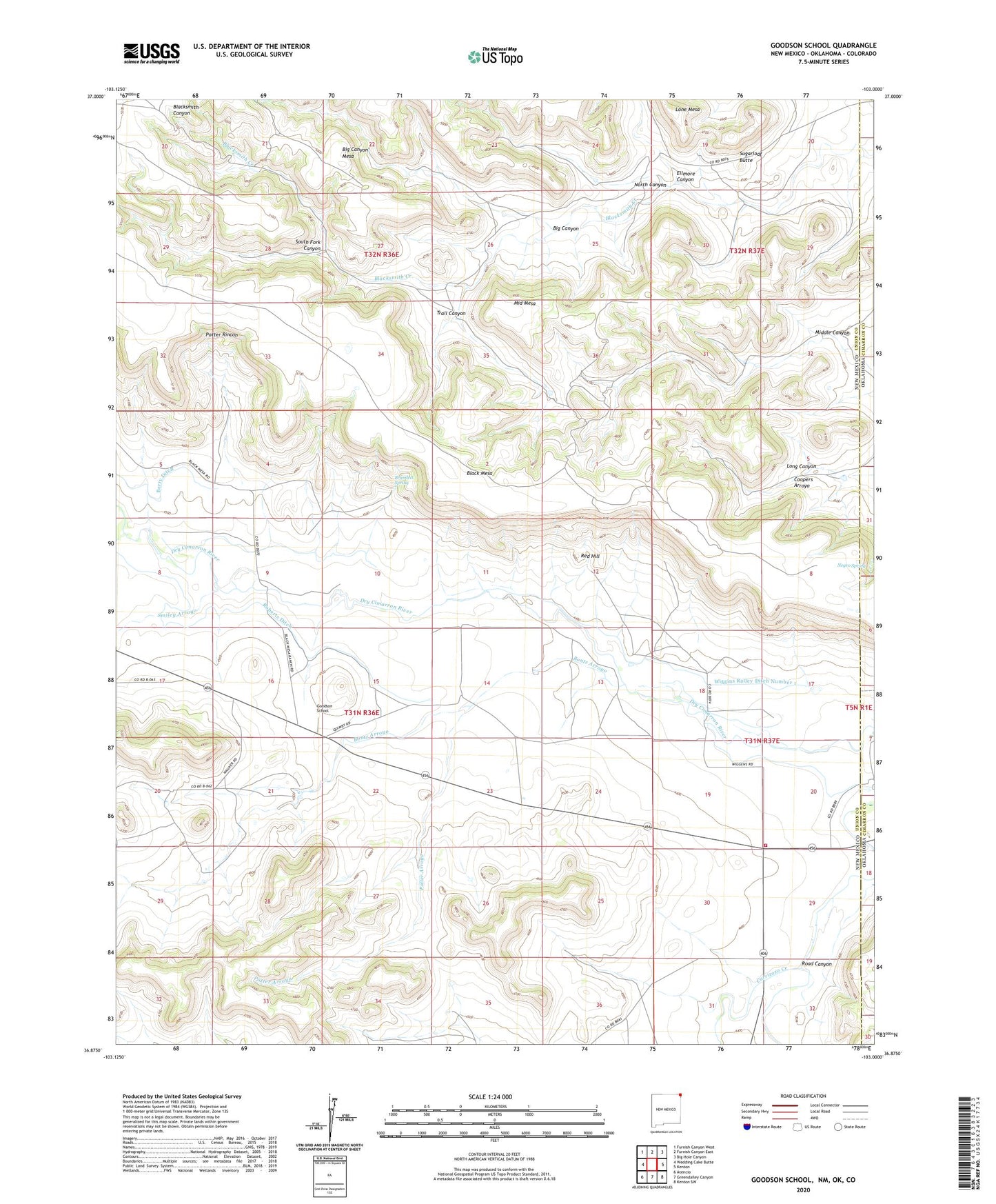
2023 topographic map quadrangle Goodson School in the states of New Mexico, Oklahoma. Scale: 1:24000. Based on the newly updated USGS 7.5' US Topo map series, this map is in the following counties: Union, Cimarron, Baca. The map contains contour data, water features, and other items you are used to seeing on USGS maps, but also has updated roads and other features. This is the next generation of topographic maps. Printed on high-quality waterproof paper with UV fade-resistant inks.
Quads adjacent to this one:
West: Wedding Cake Butte
Northwest: Furnish Canyon West
North: Furnish Canyon East
Northeast: Big Hole Canyon
East: Kenton
Southeast: Kenton SW
South: Greendailey Canyon
Southwest: Atencio
Contains the following named places: Big Canyon, Big Canyon Mesa, Black Mesa Prospect, Bontz Arroyo, Bramlett Spring, Ellmore Canyon, Goodson, Goodson School, Independence Group, Lone Mesa, Long Canyon, Middle Canyon, Middle Mesa, Negro Spring, North Canyon, North Gillespie Windmill, Potter Arroyo, Potter Rincon, Quimby, Rabbit Ear Fire Department Kenton Station, Red Hill, Rincon Windmill, Road Canyon, Roberts Ditch, Sloan Creek, Smiley Arroyo, South Fork Canyon, Sugarloaf Butte, Trail Canyon, Twin Windmill, Whitley, Wiggin, Wiggins Ralley Ditch Number 1