MyTopo
Hackberry Lake New Mexico US Topo Map
Couldn't load pickup availability
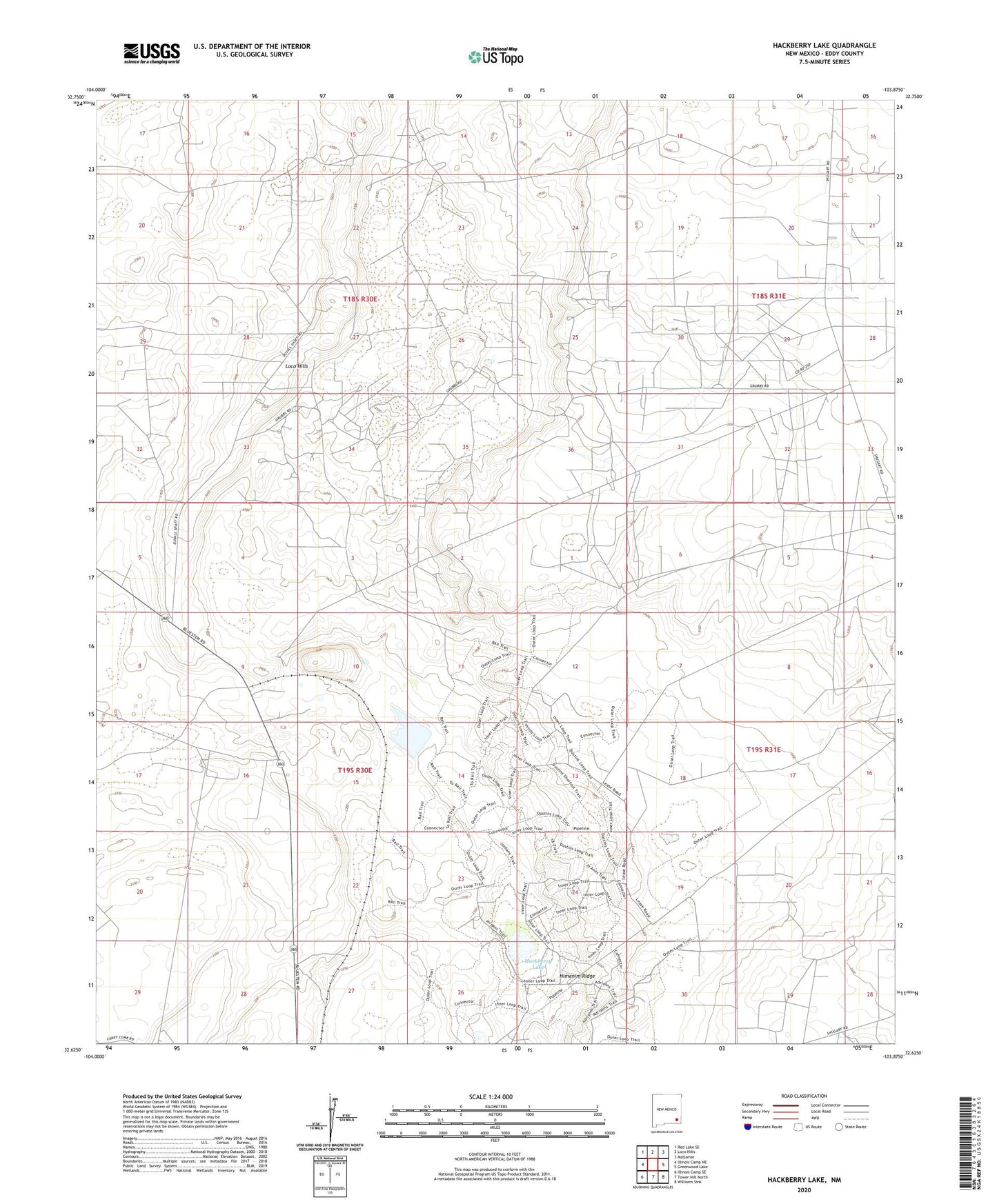
2023 topographic map quadrangle Hackberry Lake in the state of New Mexico. Scale: 1:24000. Based on the newly updated USGS 7.5' US Topo map series, this map is in the following counties: Eddy. The map contains contour data, water features, and other items you are used to seeing on USGS maps, but also has updated roads and other features. This is the next generation of topographic maps. Printed on high-quality waterproof paper with UV fade-resistant inks.
Quads adjacent to this one:
West: Illinois Camp NE
Northwest: Red Lake SE
North: Loco Hills
Northeast: Maljamar
East: Greenwood Lake
Southeast: Williams Sink
South: Tower Hill North
Southwest: Illinois Camp SE
This map covers the same area as the classic USGS quad with code o32103f8.
Contains the following named places: Amax Chemical, Amax Potash Refinery, Duval Corporation Wills-Weaver, Hackberry Lake, Loco Hills, Nimenim Ridge, Walters Lake