MyTopo
Sandia Park New Mexico US Topo Map
Couldn't load pickup availability
Also explore the Sandia Park Forest Service Topo of this same quad for updated USFS data
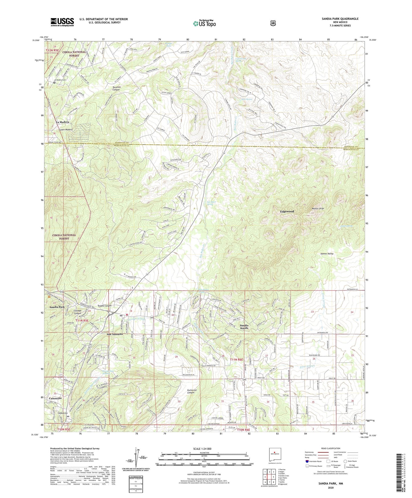
2023 topographic map quadrangle Sandia Park in the state of New Mexico. Scale: 1:24000. Based on the newly updated USGS 7.5' US Topo map series, this map is in the following counties: Bernalillo, Sandoval. The map contains contour data, water features, and other items you are used to seeing on USGS maps, but also has updated roads and other features. This is the next generation of topographic maps. Printed on high-quality waterproof paper with UV fade-resistant inks.
Quads adjacent to this one:
West: Sandia Crest
Northwest: Placitas
North: Hagan
Northeast: Golden
East: San Pedro
Southeast: Edgewood
South: Sedillo
Southwest: Tijeras
This map covers the same area as the classic USGS quad with code o35106b3.
Contains the following named places: 1 Water Well, 10 Water Well, 10035 Water Well, 10054 Water Well, 110626333 Water Well, 11N6E19313 Water Well, 13 Water Well, 130 Water Well, 132 Water Well, 143 Water Well, 144 Water Well, 145 Water Well, 146 Water Well, 211 Water Well, 212 Water Well, 213 Water Well, 239 Water Well, 24 Water Well, 241 Water Well, 242 Water Well, 243 Water Well, 244 Water Well, 257 Water Well, 45 Water Well, 534 Water Well, Aragon and Little Prospect, Armijo Trail, Arroyo Armijo, Bernalillo County Fire and Rescue Station 6, Camp Campbell, Canon Madera, Canoncito, Cedar Crest Post Office, Cienega Canyon, Community Church, Cottonwood Spring, E-609 Water Well, East Mountain High School, E-S-231 Water Well, Frost, Frost Arroyo, Gutierrez Canyon Open Space, Indian Spring, La Madera, La Madera Cemetery, La Madera Census Designated Place, Magic Valley, Mohawk Chief and Lion Mine, Monte Largo, Mountain Christian Church, Number 1 Water Well, Paa-Ko, Paa-Ko Census Designated Place, Paako Communities, Pa-ako Ruins, Pinon Ridge Estates, RG-S-231 Water Well, Rock Spring, S1 Water Well, S-121 Water Well, S-152 Water Well, S-152-S-2 Water Well, S-152X Water Well, S-162 Water Well, S-203 Water Well, S-219 Water Well, S-225 Water Well, S-241 Water Well, S-322 Water Well, S-324 Water Well, S-342 Water Well, S-383 Water Well, S-391 Water Well, S-419 Water Well, S-439 Water Well, S-472 Water Well, S-475 Water Well, S-475 Well, S-503 Water Well, S-609 Water Well, S-628 Water Well, S-656 Water Well, S-702 Water Well, S-708 Water Well, S-723 Water Well, S-838 Water Well, S-851 Water Well, S-853 Water Well, S-875 Water Well, San Antonio Catholic Mission, San Antonio Elementary School, San Antonito, San Antonito Census Designated Place, San Antonito Elementary School, San Lorenzo De Canyoncito, San Pedro Creek, San Pedro Grant, San Pedro Overlook, San Pedro Spring, Sandia Knolls, Sandia Knolls Census Designated Place, Sandia Park, Sandia Park Census Designated Place, Sandia Park Post Office, Sandia Park Weather Station, Sierra Vista Estates, Smelter Ruins, Station 1 Water Well, Tecolote Canyon, Tocco Mine, Vista Grande Community Center