MyTopo
Horn Canyon New Mexico US Topo Map
Couldn't load pickup availability
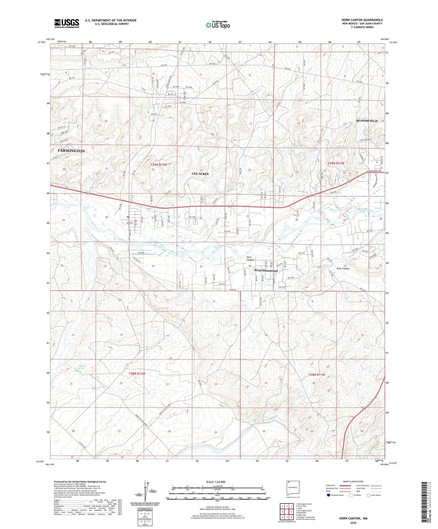
2023 topographic map quadrangle Horn Canyon in the state of New Mexico. Scale: 1:24000. Based on the newly updated USGS 7.5' US Topo map series, this map is in the following counties: San Juan. The map contains contour data, water features, and other items you are used to seeing on USGS maps, but also has updated roads and other features. This is the next generation of topographic maps. Printed on high-quality waterproof paper with UV fade-resistant inks.
Quads adjacent to this one:
West: Farmington South
Northwest: Farmington North
North: Flora Vista
Northeast: Aztec
East: Bloomfield
Southeast: East Fork Kutz Canyon
South: Gallegos Trading Post
Southwest: Hugh Lake
This map covers the same area as the classic USGS quad with code o36108f1.
Contains the following named places: Crouch Mesa, Crouch Mesa Census Designated Place, Desert Hills Church, Farmington Mennonite Cemetery, Gallegos Canyon, Gallegos Spring, George Salmon Homestead Historic Site, Hammond Main Canal, Horn Canyon, Keller Field Airport, Kutz Canyon, Kutz Canyon Ditch, Lee Acres, Lee Acres Census Designated Place, Mesa Alta Junior High School, New Mexico State University Agricultural Experimental Station, PN-1 Water Well, PN-2 Water Well, PN-3 Water Well, PN-4 Water Well, PS-1 Water Well, PS-3 Water Well, Riverside Church, Salmon Ruin Historical Marker, Salmon Ruins, San Juan County Archaeological Research Center, San Juan County Fire District 6 - Station 1 Lee Acres, West Hammond Census Designated Place