MyTopo
House New Mexico US Topo Map
Couldn't load pickup availability
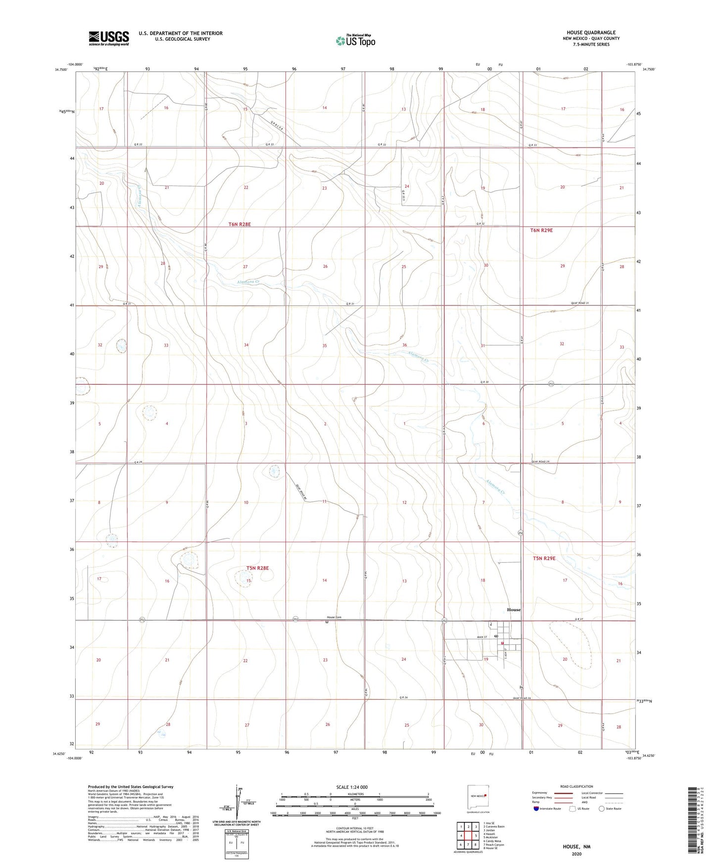
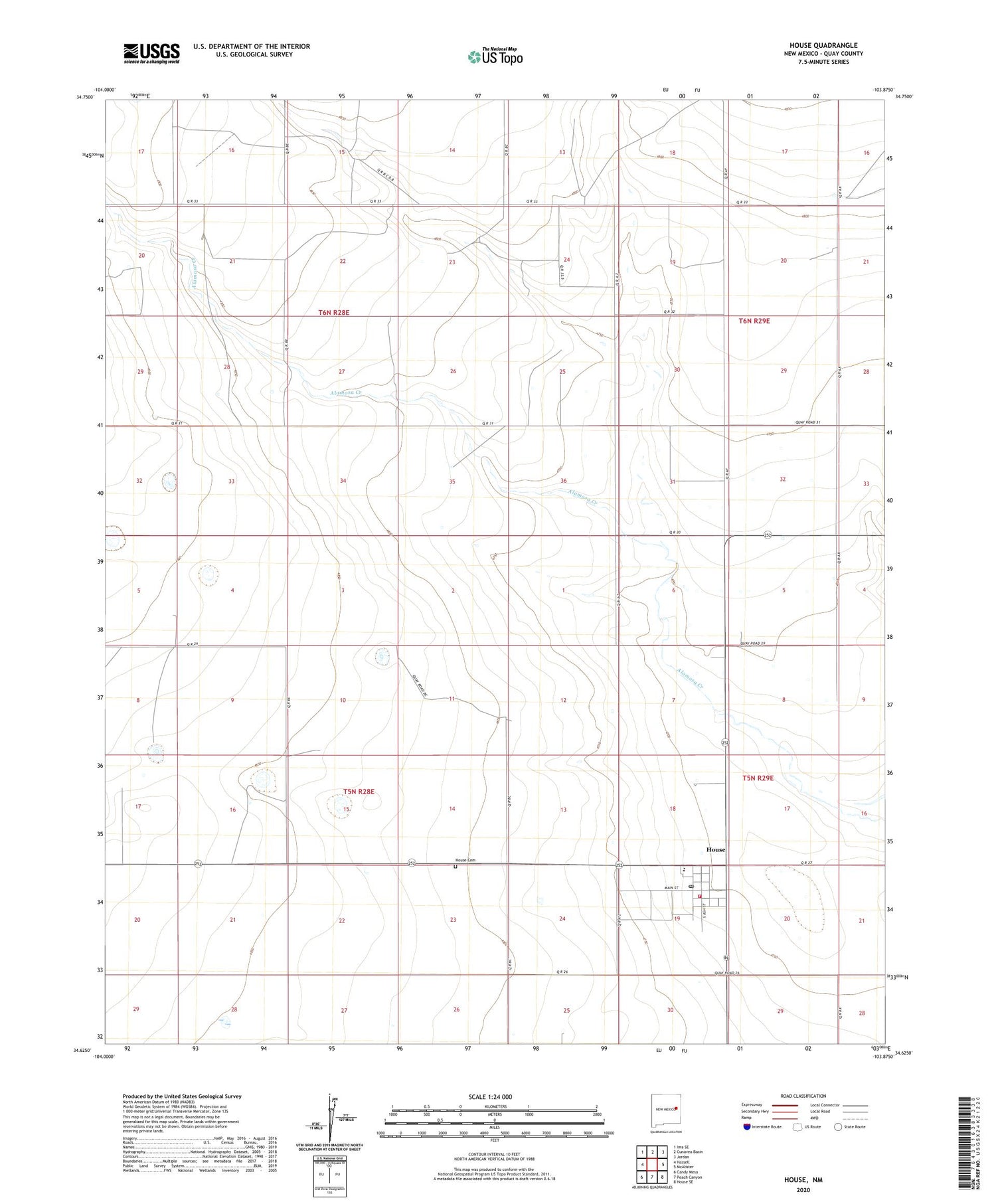
2020 topographic map quadrangle House in the state of New Mexico. Scale: 1:24000. Based on the newly updated USGS 7.5' US Topo map series, this map is in the following counties: Quay. The map contains contour data, water features, and other items you are used to seeing on USGS maps, but also has updated roads and other features. This is the next generation of topographic maps. Printed on high-quality waterproof paper with UV fade-resistant inks.
Quads adjacent to this one:
West: Hassell
Northwest: Ima SE
North: Cunavea Basin
Northeast: Jordan
East: McAlister
Southeast: House SE
South: Peach Canyon
Southwest: Candy Mesa
Contains the following named places: 10070 Water Well, 10071 Water Well, 10346 Water Well, 10348 Water Well, 10349 Water Well, 10368 Water Well, 10668 Water Well, 10704 Water Well, 88121, Bass, First Baptist Church, House, House Cemetery, House Fire and Emergency Department, House Post Office, House Weather Station, Upton, Village of House