MyTopo
Jordan New Mexico US Topo Map
Couldn't load pickup availability
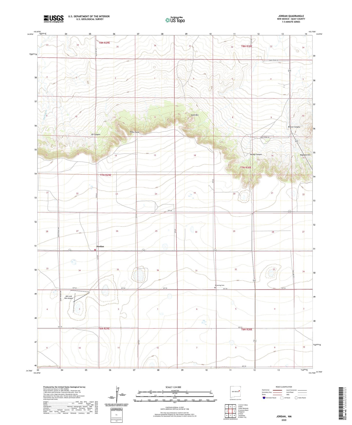
2023 topographic map quadrangle Jordan in the state of New Mexico. Scale: 1:24000. Based on the newly updated USGS 7.5' US Topo map series, this map is in the following counties: Quay. The map contains contour data, water features, and other items you are used to seeing on USGS maps, but also has updated roads and other features. This is the next generation of topographic maps. Printed on high-quality waterproof paper with UV fade-resistant inks.
Quads adjacent to this one:
West: Cunavea Basin
Northwest: Circle S Mesa
North: Quay
Northeast: Mesa Redonda
East: Ragland
Southeast: Weber City
South: McAlister
Southwest: House
This map covers the same area as the classic USGS quad with code o34103g7.
Contains the following named places: 10395 Water Well, 10551 Water Well, 10557 Water Well, 10559 Water Well, 10563 Water Well, 10564 Water Well, 10565 Water Well, 10569 Water Well, 10570 Water Well, 10573 Water Well, 10650 Water Well, 10727 Water Well, 88427, Akin and Akin Airport, Bar B Ranch, Browning Cemetery, Bucks, Honey Canyon, Ish Canyon, Jordan, Jordan Fire District Main Station, Jordan Post Office, Lawson, Pinon Point, Rincon Canyon, Sand Mountain