MyTopo
Ima SE New Mexico US Topo Map
Couldn't load pickup availability
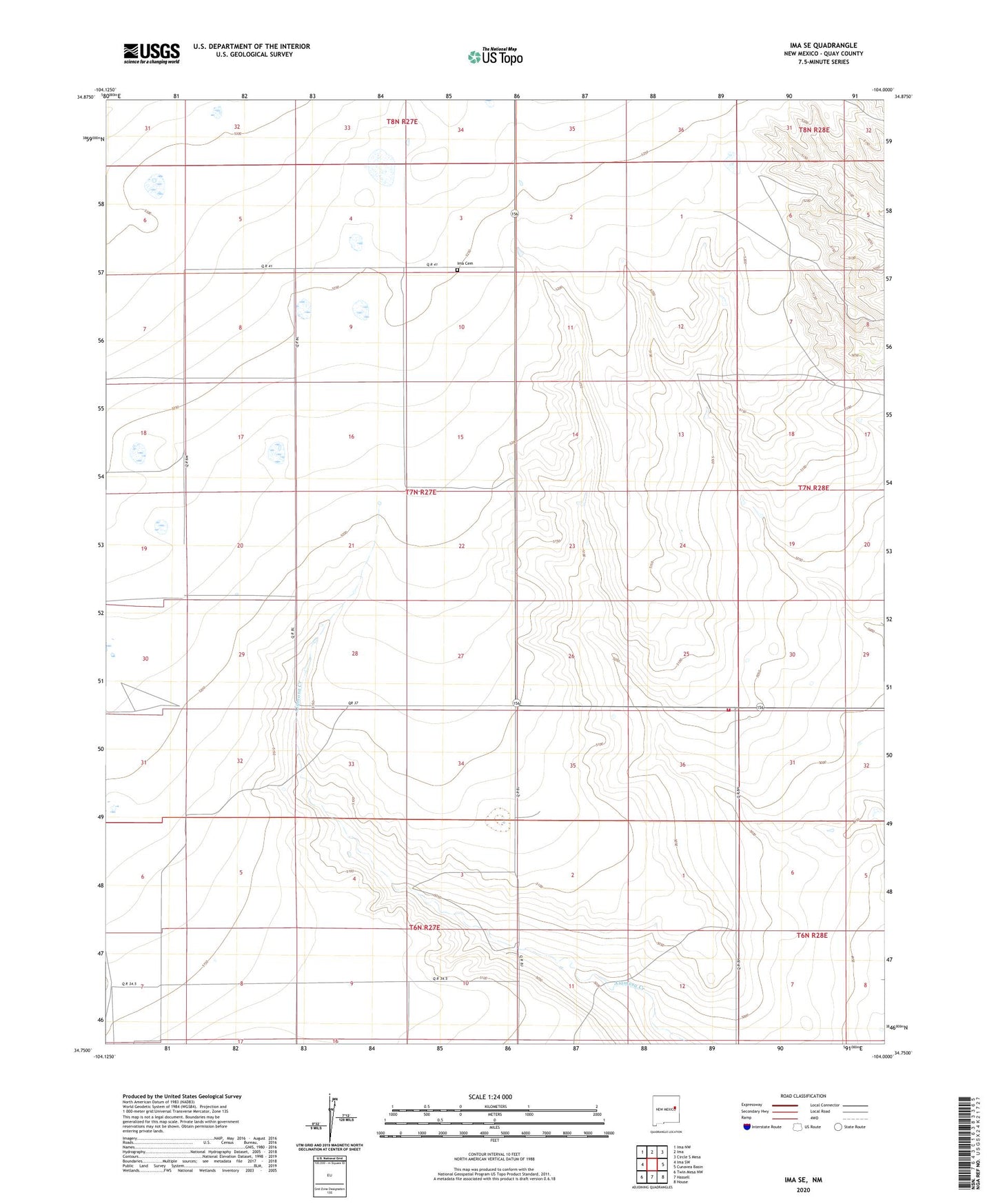
2023 topographic map quadrangle Ima SE in the state of New Mexico. Scale: 1:24000. Based on the newly updated USGS 7.5' US Topo map series, this map is in the following counties: Quay. The map contains contour data, water features, and other items you are used to seeing on USGS maps, but also has updated roads and other features. This is the next generation of topographic maps. Printed on high-quality waterproof paper with UV fade-resistant inks.
Quads adjacent to this one:
West: Ima SW
Northwest: Ima NW
North: Ima
Northeast: Circle S Mesa
East: Cunavea Basin
Southeast: House
South: Hassell
Southwest: Twin Mesa NW
This map covers the same area as the classic USGS quad with code o34104g1.
Contains the following named places: 10202 Water Well, 10261 Water Well, 10262 Water Well, 10313 Water Well, 10314 Water Well, 10332 Water Well, 10527 Water Well, 10531 Water Well, 10532 Water Well, 10533 Water Well, 10534 Water Well, 10541 Water Well, 10543 Water Well, 10544 Water Well, 10786 Water Well, Hartford, Ima Cemetery, Ima Community House, Jordan Fire District Station 2, Krilling, Lawrence Ranch, Northcutt, Peacock, Peacock Ranch, Sparks Ranch, Williams Ranch