MyTopo
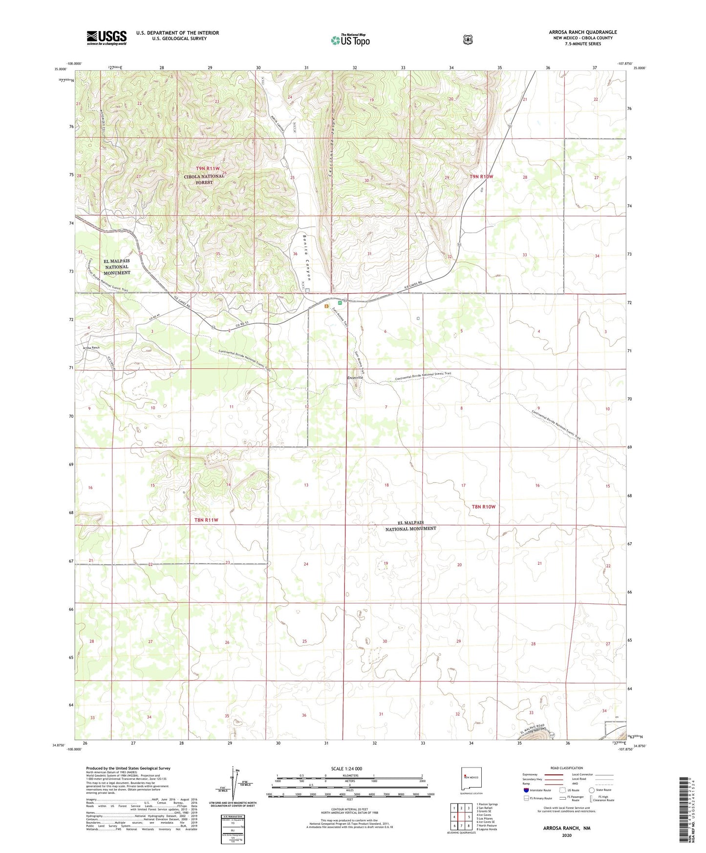
Arrosa Ranch New Mexico US Topo Map
Couldn't load pickup availability
Also explore the Arrosa Ranch Forest Service Topo of this same quad for updated USFS data
2023 topographic map quadrangle Arrosa Ranch in the state of New Mexico. Scale: 1:24000. Based on the newly updated USGS 7.5' US Topo map series, this map is in the following counties: Cibola. The map contains contour data, water features, and other items you are used to seeing on USGS maps, but also has updated roads and other features. This is the next generation of topographic maps. Printed on high-quality waterproof paper with UV fade-resistant inks.
Quads adjacent to this one:
West: Ice Caves
Northwest: Paxton Springs
North: San Rafael
Northeast: Grants SE
East: Los Pilares
Southeast: Laguna Honda
South: North Pasture
Southwest: Ice Caves SE
This map covers the same area as the classic USGS quad with code o34107h8.
Contains the following named places: Arrosa Ranch, Arrosa Ranch Water Well, Bonita Canyon, Cerritos de Jaspe, Cibola County, El Malpais National Monument, Encerrito, Grants Division, HQ Water Well, Little Hole in the Wall, Mack Prospect, Porter Ranch, Reid and Bright Ranch, The Malpais, Twenty One Mine, Twenty Seven Mine, Twenty-One Mine, Twenty-Seven Mine, Zuni Acoma Trail