MyTopo
Juan Largo Canyon West New Mexico US Topo Map
Couldn't load pickup availability
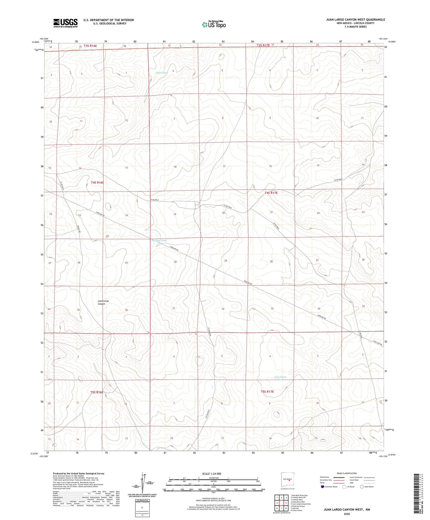
2023 topographic map quadrangle Juan Largo Canyon West in the state of New Mexico. Scale: 1:24000. Based on the newly updated USGS 7.5' US Topo map series, this map is in the following counties: Lincoln. The map contains contour data, water features, and other items you are used to seeing on USGS maps, but also has updated roads and other features. This is the next generation of topographic maps. Printed on high-quality waterproof paper with UV fade-resistant inks.
Quads adjacent to this one:
West: Golondrina Well
Northwest: Red Bluff Draw East
North: Cowboy Mesa SW
Northeast: Cowboy Mesa
East: Juan Largo Canyon East
Southeast: Cistern Draw
South: Huff Hill
Southwest: Pedernal Arroyo
This map covers the same area as the classic USGS quad with code o33105h2.
Contains the following named places: Line Camp Tank, Little Hasperos Well, Mexican Tank, Middle Well, Pipeline Tank, Richards Ranch, Road Tank