MyTopo
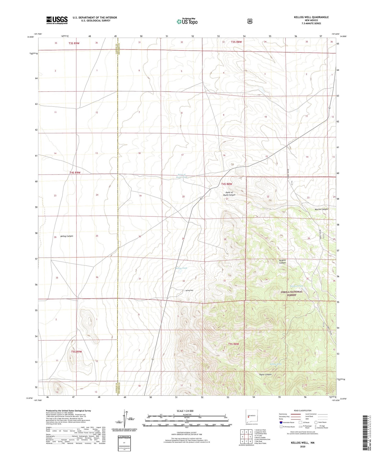
Kellog Well New Mexico US Topo Map
Couldn't load pickup availability
Also explore the Kellog Well Forest Service Topo of this same quad for updated USFS data
2023 topographic map quadrangle Kellog Well in the state of New Mexico. Scale: 1:24000. Based on the newly updated USGS 7.5' US Topo map series, this map is in the following counties: Socorro, Catron. The map contains contour data, water features, and other items you are used to seeing on USGS maps, but also has updated roads and other features. This is the next generation of topographic maps. Printed on high-quality waterproof paper with UV fade-resistant inks.
Quads adjacent to this one:
West: C-N Lake
Northwest: Anderson Peak
North: Augustine Well
Northeast: Arrowhead Well
East: Monica Saddle
Southeast: Bay Buck Peaks
South: Oak Peak
Southwest: Luera Mountains East
This map covers the same area as the classic USGS quad with code o33107h6.
Contains the following named places: Fox Well, Kellog Canyon, Kellog Tank, Kellog Well, Morine Canyon, Old Sand Well, Point of Rocks Canyon, Point of Rocks Tank, Sargent Canyon, Sargent Tank, Satathite Place, Satathite Water Well, Sexton Well, Taylor Canyon, White Well, ZIP Code: 87825