MyTopo
Luera Mountains East New Mexico US Topo Map
Couldn't load pickup availability
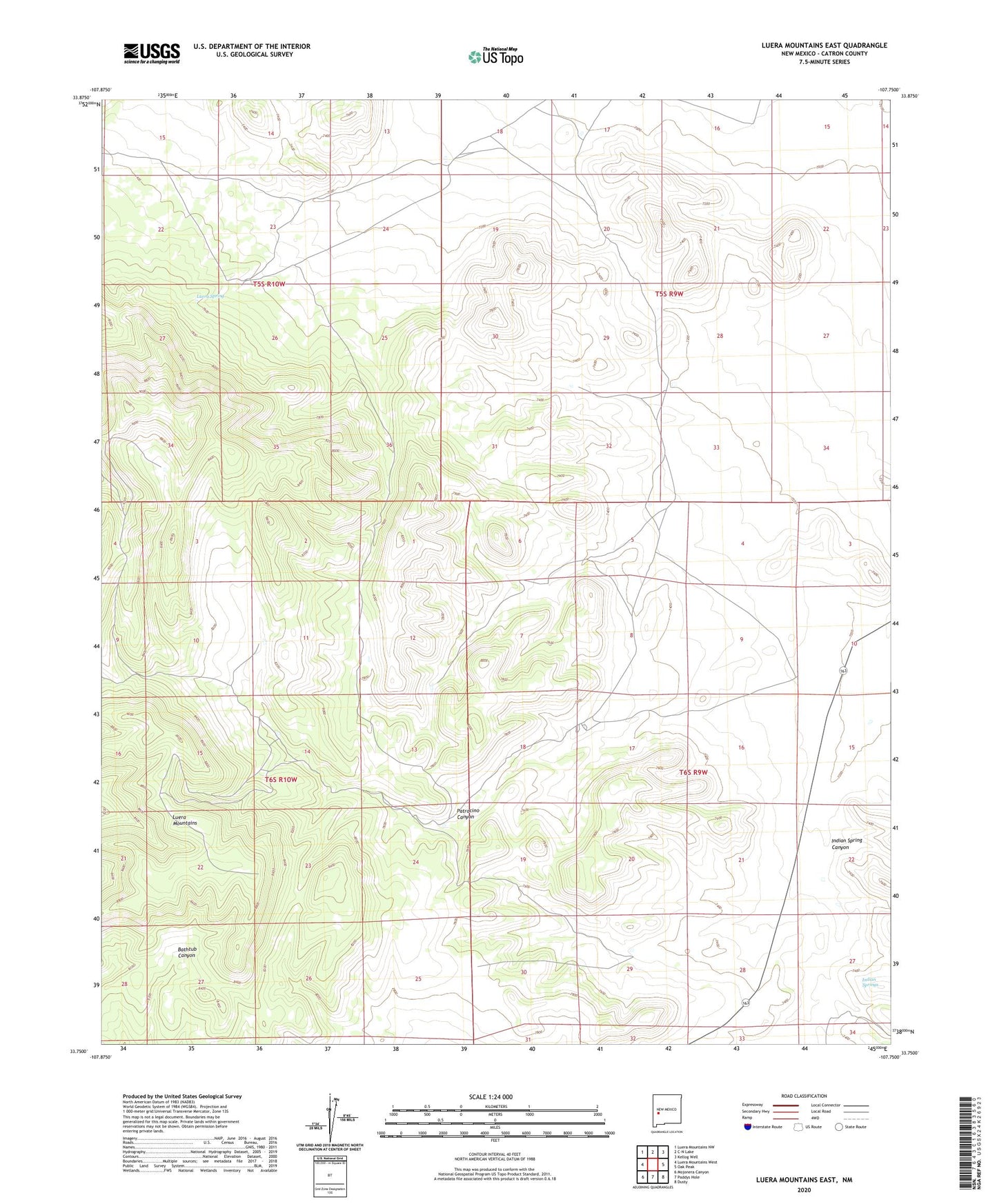
2023 topographic map quadrangle Luera Mountains East in the state of New Mexico. Scale: 1:24000. Based on the newly updated USGS 7.5' US Topo map series, this map is in the following counties: Catron. The map contains contour data, water features, and other items you are used to seeing on USGS maps, but also has updated roads and other features. This is the next generation of topographic maps. Printed on high-quality waterproof paper with UV fade-resistant inks.
Quads adjacent to this one:
West: Luera Mountains West
Northwest: Luera Mountains NW
North: C-N Lake
Northeast: Kellog Well
East: Oak Peak
Southeast: Dusty
South: Paddys Hole
Southwest: Mojonera Canyon
This map covers the same area as the classic USGS quad with code o33107g7.
Contains the following named places: Indian Spring Canyon, Indian Springs, Luera Ranch, Luera Spring, Patrocino Canyon